You are here: Home > Network List > US - United States National Seismic Network Stations List
> Station MSO Missoula, Montana, USA > Earthquake Result Viewer
MSO Missoula, Montana, USA - Earthquake Result Viewer
*The percent match for this event was below the threshold and hence no stack was calculated.
| Earthquake location: |
South Of Panama |
| Earthquake latitude/longitude: |
6.8/-82.4 |
| Earthquake time(UTC): |
2021/05/13 (133) 09:42:12 GMT |
| Earthquake Depth: |
10 km |
| Earthquake Magnitude: |
6.0 mww |
| Earthquake Catalog/Contributor: |
NEIC PDE/us |
|
| Network: |
US United States National Seismic Network |
| Station: |
MSO Missoula, Montana, USA |
| Lat/Lon: |
46.83 N/113.94 W |
| Elevation: |
1264 m |
|
| Distance: |
48.2 deg |
| Az: |
331.204 deg |
| Baz: |
135.834 deg |
| Ray Param: |
$rayparam |
*The percent match for this event was below the threshold and hence was not used in the summary stack. |
|
| Radial Match: |
67.40217 % |
| Radial Bump: |
400 |
| Transverse Match: |
61.176548 % |
| Transverse Bump: |
400 |
| SOD ConfigId: |
24890451 |
| Insert Time: |
2021-06-02 15:48:32.656 +0000 |
| GWidth: |
2.5 |
| Max Bumps: |
400 |
| Tol: |
0.001 |
|
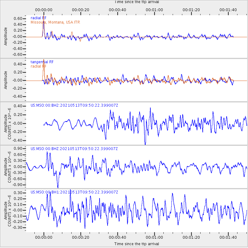
Signal To Noise
| Channel | StoN | STA | LTA |
| US:MSO:00:BHZ:20210513T09:50:22.399007Z | 3.551809 | 3.371982E-7 | 9.4937036E-8 |
| US:MSO:00:BH1:20210513T09:50:22.399007Z | 2.4466856 | 1.4109179E-7 | 5.7666494E-8 |
| US:MSO:00:BH2:20210513T09:50:22.399007Z | 2.3414524 | 1.4604689E-7 | 6.237449E-8 |
| Arrivals |
| Ps | |
| PpPs | |
| PsPs/PpSs | |


