You are here: Home > Network List > US - United States National Seismic Network Stations List
> Station DGMT Dagmar, Montana, USA > Earthquake Result Viewer
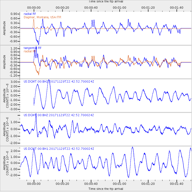
DGMT Dagmar, Montana, USA - Earthquake Result Viewer
*The percent match for this event was below the threshold and hence no stack was calculated.
| Earthquake location: |
Kuril Islands |
| Earthquake latitude/longitude: |
45.2/146.3 |
| Earthquake time(UTC): |
2017/11/29 (333) 22:32:23 GMT |
| Earthquake Depth: |
10 km |
| Earthquake Magnitude: |
5.4 Mww |
| Earthquake Catalog/Contributor: |
NEIC PDE/us |
|
| Network: |
US United States National Seismic Network |
| Station: |
DGMT Dagmar, Montana, USA |
| Lat/Lon: |
48.47 N/104.20 W |
| Elevation: |
0.0 m |
|
| Distance: |
68.3 deg |
| Az: |
42.476 deg |
| Baz: |
314.148 deg |
| Ray Param: |
$rayparam |
*The percent match for this event was below the threshold and hence was not used in the summary stack. |
|
| Radial Match: |
75.62734 % |
| Radial Bump: |
400 |
| Transverse Match: |
59.29957 % |
| Transverse Bump: |
332 |
| SOD ConfigId: |
2429771 |
| Insert Time: |
2017-12-13 22:37:48.885 +0000 |
| GWidth: |
2.5 |
| Max Bumps: |
400 |
| Tol: |
0.001 |
|
Signal To Noise
| Channel | StoN | STA | LTA |
| US:DGMT:00:BHZ:20171129T22:42:52.700024Z | 1.6389185 | 8.329254E-7 | 5.082165E-7 |
| US:DGMT:00:BH1:20171129T22:42:52.700024Z | 1.2628028 | 1.3271588E-6 | 1.0509627E-6 |
| US:DGMT:00:BH2:20171129T22:42:52.700024Z | 0.76685786 | 1.2920907E-6 | 1.6849157E-6 |
| Arrivals |
| Ps | |
| PpPs | |
| PsPs/PpSs | |


