You are here: Home > Network List > CI - Caltech Regional Seismic Network Stations List
> Station SWS Sam W. Stewart, Westmorland, CA, USA > Earthquake Result Viewer
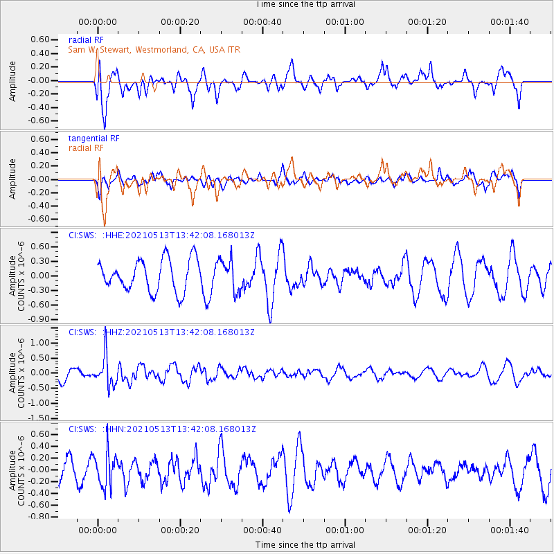
SWS Sam W. Stewart, Westmorland, CA, USA - Earthquake Result Viewer
*The percent match for this event was below the threshold and hence no stack was calculated.
| Earthquake location: |
Fiji Islands Region |
| Earthquake latitude/longitude: |
-15.9/-177.4 |
| Earthquake time(UTC): |
2021/05/13 (133) 13:31:35 GMT |
| Earthquake Depth: |
424 km |
| Earthquake Magnitude: |
5.7 Mww |
| Earthquake Catalog/Contributor: |
NEIC PDE/us |
|
| Network: |
CI Caltech Regional Seismic Network |
| Station: |
SWS Sam W. Stewart, Westmorland, CA, USA |
| Lat/Lon: |
32.94 N/115.80 W |
| Elevation: |
140 m |
|
| Distance: |
76.3 deg |
| Az: |
49.607 deg |
| Baz: |
240.616 deg |
| Ray Param: |
$rayparam |
*The percent match for this event was below the threshold and hence was not used in the summary stack. |
|
| Radial Match: |
66.28136 % |
| Radial Bump: |
400 |
| Transverse Match: |
50.911854 % |
| Transverse Bump: |
400 |
| SOD ConfigId: |
24890451 |
| Insert Time: |
2021-06-02 16:03:17.814 +0000 |
| GWidth: |
2.5 |
| Max Bumps: |
400 |
| Tol: |
0.001 |
|
Signal To Noise
| Channel | StoN | STA | LTA |
| CI:SWS: :HHZ:20210513T13:42:08.168013Z | 2.5376666 | 5.2594294E-7 | 2.0725453E-7 |
| CI:SWS: :HHN:20210513T13:42:08.168013Z | 1.3463287 | 2.86398E-7 | 2.1272517E-7 |
| CI:SWS: :HHE:20210513T13:42:08.168013Z | 1.0385791 | 3.3785506E-7 | 3.2530508E-7 |
| Arrivals |
| Ps | |
| PpPs | |
| PsPs/PpSs | |


