You are here: Home > Network List > UU - University of Utah Regional Network Stations List
> Station KNB Kanab, UT, USA > Earthquake Result Viewer
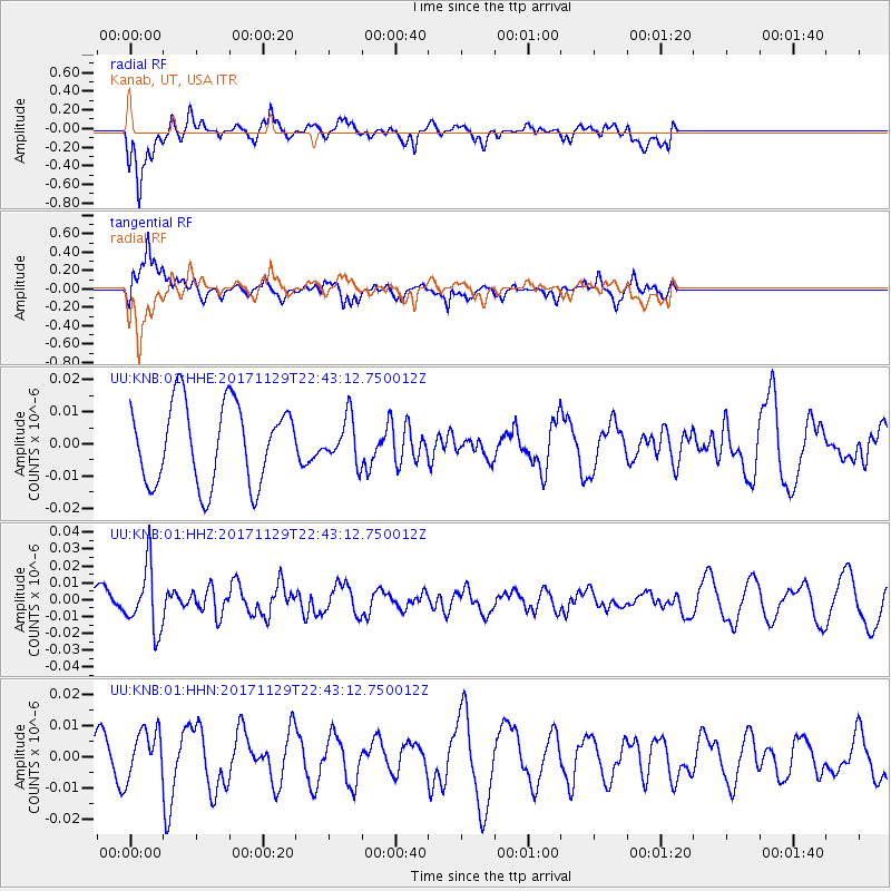
KNB Kanab, UT, USA - Earthquake Result Viewer
*The percent match for this event was below the threshold and hence no stack was calculated.
| Earthquake location: |
Kuril Islands |
| Earthquake latitude/longitude: |
45.2/146.3 |
| Earthquake time(UTC): |
2017/11/29 (333) 22:32:23 GMT |
| Earthquake Depth: |
10 km |
| Earthquake Magnitude: |
5.4 Mww |
| Earthquake Catalog/Contributor: |
NEIC PDE/us |
|
| Network: |
UU University of Utah Regional Network |
| Station: |
KNB Kanab, UT, USA |
| Lat/Lon: |
37.02 N/112.82 W |
| Elevation: |
1715 m |
|
| Distance: |
71.5 deg |
| Az: |
55.961 deg |
| Baz: |
312.936 deg |
| Ray Param: |
$rayparam |
*The percent match for this event was below the threshold and hence was not used in the summary stack. |
|
| Radial Match: |
56.32242 % |
| Radial Bump: |
400 |
| Transverse Match: |
72.666855 % |
| Transverse Bump: |
400 |
| SOD ConfigId: |
2429771 |
| Insert Time: |
2017-12-13 22:38:51.912 +0000 |
| GWidth: |
2.5 |
| Max Bumps: |
400 |
| Tol: |
0.001 |
|
Signal To Noise
| Channel | StoN | STA | LTA |
| UU:KNB:01:HHZ:20171129T22:43:12.750012Z | 2.924054 | 1.8908942E-8 | 6.466687E-9 |
| UU:KNB:01:HHN:20171129T22:43:12.750012Z | 0.85108435 | 7.8086995E-9 | 9.175E-9 |
| UU:KNB:01:HHE:20171129T22:43:12.750012Z | 0.5451579 | 6.7936936E-9 | 1.2461883E-8 |
| Arrivals |
| Ps | |
| PpPs | |
| PsPs/PpSs | |


