You are here: Home > Network List > G - GEOSCOPE Stations List
> Station INU Inuyama, Japan > Earthquake Result Viewer
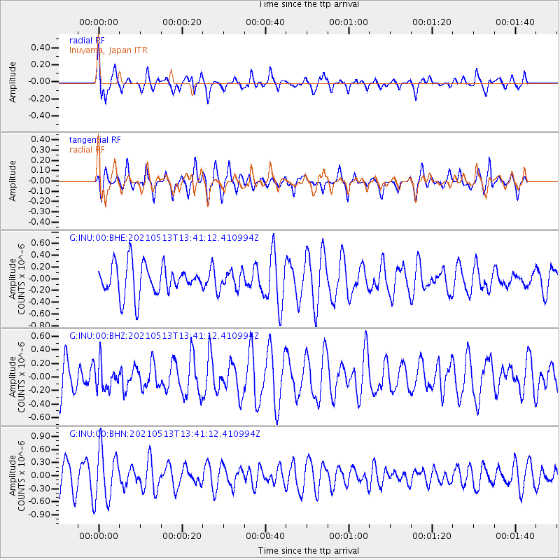
INU Inuyama, Japan - Earthquake Result Viewer
*The percent match for this event was below the threshold and hence no stack was calculated.
| Earthquake location: |
Fiji Islands Region |
| Earthquake latitude/longitude: |
-15.9/-177.4 |
| Earthquake time(UTC): |
2021/05/13 (133) 13:31:35 GMT |
| Earthquake Depth: |
424 km |
| Earthquake Magnitude: |
5.7 Mww |
| Earthquake Catalog/Contributor: |
NEIC PDE/us |
|
| Network: |
G GEOSCOPE |
| Station: |
INU Inuyama, Japan |
| Lat/Lon: |
35.35 N/137.03 E |
| Elevation: |
132 m |
|
| Distance: |
66.8 deg |
| Az: |
320.61 deg |
| Baz: |
131.683 deg |
| Ray Param: |
$rayparam |
*The percent match for this event was below the threshold and hence was not used in the summary stack. |
|
| Radial Match: |
49.658665 % |
| Radial Bump: |
396 |
| Transverse Match: |
39.466053 % |
| Transverse Bump: |
361 |
| SOD ConfigId: |
24890451 |
| Insert Time: |
2021-06-02 16:05:04.898 +0000 |
| GWidth: |
2.5 |
| Max Bumps: |
400 |
| Tol: |
0.001 |
|
Signal To Noise
| Channel | StoN | STA | LTA |
| G:INU:00:BHZ:20210513T13:41:12.410994Z | 0.8069877 | 1.9034411E-7 | 2.358699E-7 |
| G:INU:00:BHN:20210513T13:41:12.410994Z | 1.5455313 | 5.799167E-7 | 3.752216E-7 |
| G:INU:00:BHE:20210513T13:41:12.410994Z | 0.55396193 | 1.4405593E-7 | 2.6004662E-7 |
| Arrivals |
| Ps | |
| PpPs | |
| PsPs/PpSs | |


