You are here: Home > Network List > US - United States National Seismic Network Stations List
> Station HAWA Hanford, Washington, USA > Earthquake Result Viewer
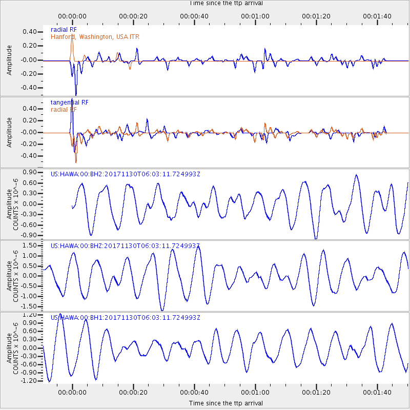
HAWA Hanford, Washington, USA - Earthquake Result Viewer
*The percent match for this event was below the threshold and hence no stack was calculated.
| Earthquake location: |
New Guinea, Papua New Guinea |
| Earthquake latitude/longitude: |
-4.4/143.8 |
| Earthquake time(UTC): |
2017/11/30 (334) 05:50:19 GMT |
| Earthquake Depth: |
98 km |
| Earthquake Magnitude: |
5.5 Mww |
| Earthquake Catalog/Contributor: |
NEIC PDE/us |
|
| Network: |
US United States National Seismic Network |
| Station: |
HAWA Hanford, Washington, USA |
| Lat/Lon: |
46.39 N/119.53 W |
| Elevation: |
364 m |
|
| Distance: |
97.7 deg |
| Az: |
43.93 deg |
| Baz: |
271.808 deg |
| Ray Param: |
$rayparam |
*The percent match for this event was below the threshold and hence was not used in the summary stack. |
|
| Radial Match: |
65.41862 % |
| Radial Bump: |
372 |
| Transverse Match: |
41.291416 % |
| Transverse Bump: |
400 |
| SOD ConfigId: |
2429771 |
| Insert Time: |
2017-12-14 05:52:57.225 +0000 |
| GWidth: |
2.5 |
| Max Bumps: |
400 |
| Tol: |
0.001 |
|
Signal To Noise
| Channel | StoN | STA | LTA |
| US:HAWA:00:BHZ:20171130T06:03:11.724993Z | 2.2492812 | 8.904842E-7 | 3.9589725E-7 |
| US:HAWA:00:BH1:20171130T06:03:11.724993Z | 1.7759676 | 7.4424554E-7 | 4.1906483E-7 |
| US:HAWA:00:BH2:20171130T06:03:11.724993Z | 0.60570925 | 2.6941723E-7 | 4.4479626E-7 |
| Arrivals |
| Ps | |
| PpPs | |
| PsPs/PpSs | |


