You are here: Home > Network List > CI - Caltech Regional Seismic Network Stations List
> Station BAR Barrett, Tecate, CA, USA > Earthquake Result Viewer
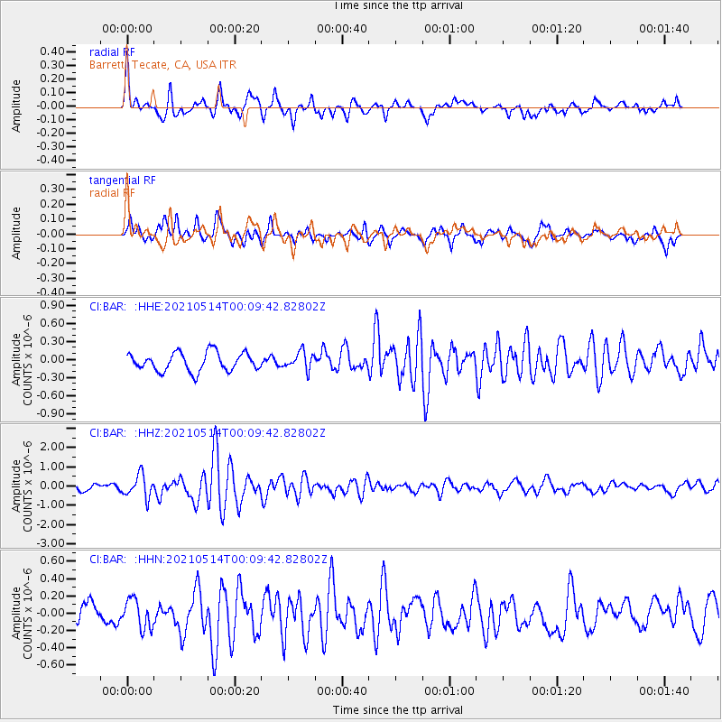
BAR Barrett, Tecate, CA, USA - Earthquake Result Viewer
*The percent match for this event was below the threshold and hence no stack was calculated.
| Earthquake location: |
Near East Coast Of Honshu, Japan |
| Earthquake latitude/longitude: |
37.7/141.8 |
| Earthquake time(UTC): |
2021/05/13 (133) 23:58:14 GMT |
| Earthquake Depth: |
32 km |
| Earthquake Magnitude: |
6.0 mww |
| Earthquake Catalog/Contributor: |
NEIC PDE/us |
|
| Network: |
CI Caltech Regional Seismic Network |
| Station: |
BAR Barrett, Tecate, CA, USA |
| Lat/Lon: |
32.68 N/116.67 W |
| Elevation: |
521 m |
|
| Distance: |
78.8 deg |
| Az: |
57.369 deg |
| Baz: |
307.626 deg |
| Ray Param: |
$rayparam |
*The percent match for this event was below the threshold and hence was not used in the summary stack. |
|
| Radial Match: |
78.86621 % |
| Radial Bump: |
400 |
| Transverse Match: |
72.73054 % |
| Transverse Bump: |
400 |
| SOD ConfigId: |
24890451 |
| Insert Time: |
2021-06-02 16:29:08.072 +0000 |
| GWidth: |
2.5 |
| Max Bumps: |
400 |
| Tol: |
0.001 |
|
Signal To Noise
| Channel | StoN | STA | LTA |
| CI:BAR: :HHZ:20210514T00:09:42.82802Z | 4.630322 | 5.897266E-7 | 1.273619E-7 |
| CI:BAR: :HHN:20210514T00:09:42.82802Z | 1.167059 | 1.6886656E-7 | 1.4469411E-7 |
| CI:BAR: :HHE:20210514T00:09:42.82802Z | 0.96345294 | 1.4728808E-7 | 1.5287522E-7 |
| Arrivals |
| Ps | |
| PpPs | |
| PsPs/PpSs | |


