You are here: Home > Network List > GS - US Geological Survey Networks Stations List
> Station DEC06 Boomer > Earthquake Result Viewer
DEC06 Boomer - Earthquake Result Viewer
*The percent match for this event was below the threshold and hence no stack was calculated.
| Earthquake location: |
Central Mid-Atlantic Ridge |
| Earthquake latitude/longitude: |
-1.1/-23.5 |
| Earthquake time(UTC): |
2017/11/30 (334) 06:32:52 GMT |
| Earthquake Depth: |
10 km |
| Earthquake Magnitude: |
6.5 Mi |
| Earthquake Catalog/Contributor: |
NEIC PDE/at |
|
| Network: |
GS US Geological Survey Networks |
| Station: |
DEC06 Boomer |
| Lat/Lon: |
39.90 N/88.95 W |
| Elevation: |
215 m |
|
| Distance: |
72.1 deg |
| Az: |
312.662 deg |
| Baz: |
107.119 deg |
| Ray Param: |
$rayparam |
*The percent match for this event was below the threshold and hence was not used in the summary stack. |
|
| Radial Match: |
42.9534 % |
| Radial Bump: |
400 |
| Transverse Match: |
43.927593 % |
| Transverse Bump: |
400 |
| SOD ConfigId: |
2429771 |
| Insert Time: |
2017-12-14 06:36:59.260 +0000 |
| GWidth: |
2.5 |
| Max Bumps: |
400 |
| Tol: |
0.001 |
|
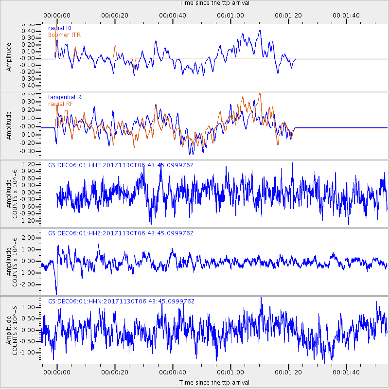
Signal To Noise
| Channel | StoN | STA | LTA |
| GS:DEC06:01:HHZ:20171130T06:43:45.099976Z | 3.3959172 | 1.013735E-6 | 2.9851583E-7 |
| GS:DEC06:01:HHN:20171130T06:43:45.099976Z | 1.0340058 | 4.206542E-7 | 4.0682E-7 |
| GS:DEC06:01:HHE:20171130T06:43:45.099976Z | 1.854146 | 5.8264123E-7 | 3.1423696E-7 |
| Arrivals |
| Ps | |
| PpPs | |
| PsPs/PpSs | |


