You are here: Home > Network List > US - United States National Seismic Network Stations List
> Station DGMT Dagmar, Montana, USA > Earthquake Result Viewer
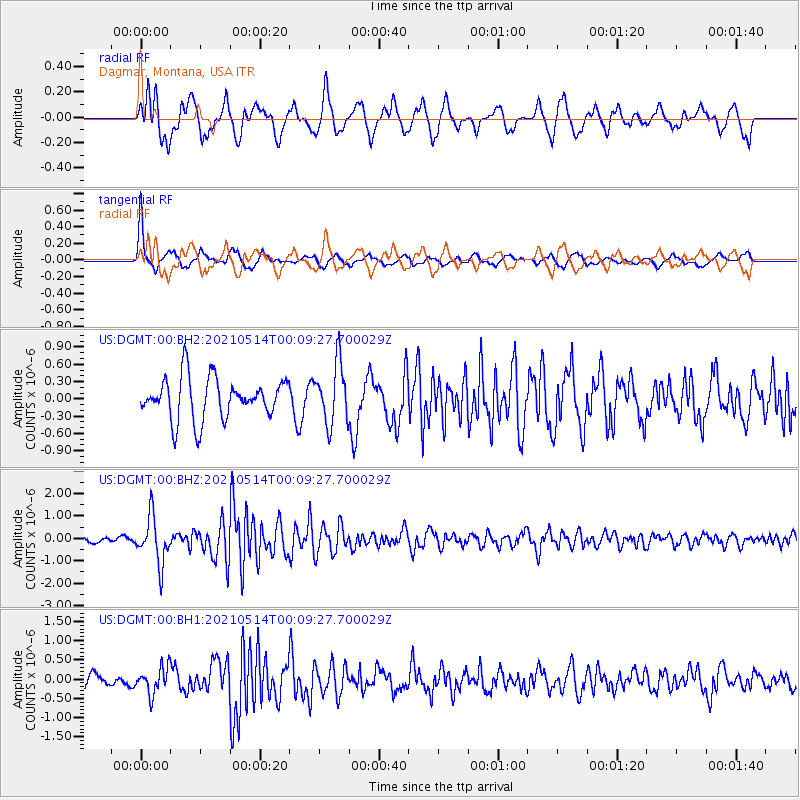
DGMT Dagmar, Montana, USA - Earthquake Result Viewer
*The percent match for this event was below the threshold and hence no stack was calculated.
| Earthquake location: |
Near East Coast Of Honshu, Japan |
| Earthquake latitude/longitude: |
37.7/141.8 |
| Earthquake time(UTC): |
2021/05/13 (133) 23:58:14 GMT |
| Earthquake Depth: |
32 km |
| Earthquake Magnitude: |
6.0 mww |
| Earthquake Catalog/Contributor: |
NEIC PDE/us |
|
| Network: |
US United States National Seismic Network |
| Station: |
DGMT Dagmar, Montana, USA |
| Lat/Lon: |
48.47 N/104.20 W |
| Elevation: |
0.0 m |
|
| Distance: |
76.1 deg |
| Az: |
38.763 deg |
| Baz: |
311.742 deg |
| Ray Param: |
$rayparam |
*The percent match for this event was below the threshold and hence was not used in the summary stack. |
|
| Radial Match: |
74.40653 % |
| Radial Bump: |
400 |
| Transverse Match: |
87.2021 % |
| Transverse Bump: |
392 |
| SOD ConfigId: |
24890451 |
| Insert Time: |
2021-06-02 16:50:40.349 +0000 |
| GWidth: |
2.5 |
| Max Bumps: |
400 |
| Tol: |
0.001 |
|
Signal To Noise
| Channel | StoN | STA | LTA |
| US:DGMT:00:BHZ:20210514T00:09:27.700029Z | 4.896263 | 1.0437905E-6 | 2.1318104E-7 |
| US:DGMT:00:BH1:20210514T00:09:27.700029Z | 1.7069163 | 3.4343918E-7 | 2.0120446E-7 |
| US:DGMT:00:BH2:20210514T00:09:27.700029Z | 1.4599831 | 5.247324E-7 | 3.594099E-7 |
| Arrivals |
| Ps | |
| PpPs | |
| PsPs/PpSs | |


