You are here: Home > Network List > US - United States National Seismic Network Stations List
> Station HAWA Hanford, Washington, USA > Earthquake Result Viewer
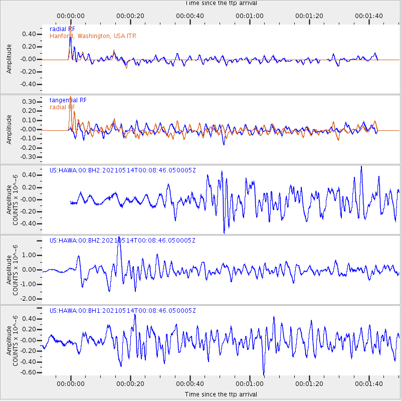
HAWA Hanford, Washington, USA - Earthquake Result Viewer
*The percent match for this event was below the threshold and hence no stack was calculated.
| Earthquake location: |
Near East Coast Of Honshu, Japan |
| Earthquake latitude/longitude: |
37.7/141.8 |
| Earthquake time(UTC): |
2021/05/13 (133) 23:58:14 GMT |
| Earthquake Depth: |
32 km |
| Earthquake Magnitude: |
6.0 mww |
| Earthquake Catalog/Contributor: |
NEIC PDE/us |
|
| Network: |
US United States National Seismic Network |
| Station: |
HAWA Hanford, Washington, USA |
| Lat/Lon: |
46.39 N/119.53 W |
| Elevation: |
364 m |
|
| Distance: |
69.1 deg |
| Az: |
47.085 deg |
| Baz: |
302.943 deg |
| Ray Param: |
$rayparam |
*The percent match for this event was below the threshold and hence was not used in the summary stack. |
|
| Radial Match: |
79.704 % |
| Radial Bump: |
400 |
| Transverse Match: |
83.3658 % |
| Transverse Bump: |
400 |
| SOD ConfigId: |
24890451 |
| Insert Time: |
2021-06-02 16:50:52.069 +0000 |
| GWidth: |
2.5 |
| Max Bumps: |
400 |
| Tol: |
0.001 |
|
Signal To Noise
| Channel | StoN | STA | LTA |
| US:HAWA:00:BHZ:20210514T00:08:46.050005Z | 8.607106 | 5.590595E-7 | 6.495325E-8 |
| US:HAWA:00:BH1:20210514T00:08:46.050005Z | 1.7910807 | 1.1072552E-7 | 6.182051E-8 |
| US:HAWA:00:BH2:20210514T00:08:46.050005Z | 2.260176 | 1.2130374E-7 | 5.3670046E-8 |
| Arrivals |
| Ps | |
| PpPs | |
| PsPs/PpSs | |


