You are here: Home > Network List > AV - Alaska Volcano Observatory Stations List
> Station MAPS Pakushin Southeast, Makushin Volcano, Alaska > Earthquake Result Viewer
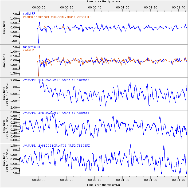
MAPS Pakushin Southeast, Makushin Volcano, Alaska - Earthquake Result Viewer
*The percent match for this event was below the threshold and hence no stack was calculated.
| Earthquake location: |
Off W Coast Of Northern Sumatra |
| Earthquake latitude/longitude: |
0.1/96.6 |
| Earthquake time(UTC): |
2021/05/14 (134) 06:33:07 GMT |
| Earthquake Depth: |
11 km |
| Earthquake Magnitude: |
6.7 mww |
| Earthquake Catalog/Contributor: |
NEIC PDE/us |
|
| Network: |
AV Alaska Volcano Observatory |
| Station: |
MAPS Pakushin Southeast, Makushin Volcano, Alaska |
| Lat/Lon: |
53.81 N/166.94 W |
| Elevation: |
333 m |
|
| Distance: |
93.7 deg |
| Az: |
36.198 deg |
| Baz: |
275.253 deg |
| Ray Param: |
$rayparam |
*The percent match for this event was below the threshold and hence was not used in the summary stack. |
|
| Radial Match: |
65.68498 % |
| Radial Bump: |
400 |
| Transverse Match: |
79.73386 % |
| Transverse Bump: |
400 |
| SOD ConfigId: |
24890451 |
| Insert Time: |
2021-06-02 16:58:09.253 +0000 |
| GWidth: |
2.5 |
| Max Bumps: |
400 |
| Tol: |
0.001 |
|
Signal To Noise
| Channel | StoN | STA | LTA |
| AV:MAPS: :BHZ:20210514T06:45:52.738985Z | 1.0213205 | 3.1353542E-7 | 3.0699024E-7 |
| AV:MAPS: :BHN:20210514T06:45:52.738985Z | 1.1370667 | 9.536712E-7 | 8.3871174E-7 |
| AV:MAPS: :BHE:20210514T06:45:52.738985Z | 1.096023 | 7.590507E-7 | 6.9255003E-7 |
| Arrivals |
| Ps | |
| PpPs | |
| PsPs/PpSs | |


