You are here: Home > Network List > AZ - ANZA Regional Network Stations List
> Station SMER AZ.SMER > Earthquake Result Viewer
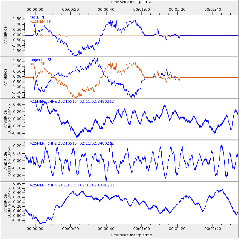
SMER AZ.SMER - Earthquake Result Viewer
*The percent match for this event was below the threshold and hence no stack was calculated.
| Earthquake location: |
Southeast Of Loyalty Islands |
| Earthquake latitude/longitude: |
-21.8/170.1 |
| Earthquake time(UTC): |
2021/05/15 (135) 01:58:43 GMT |
| Earthquake Depth: |
20 km |
| Earthquake Magnitude: |
5.5 Mww |
| Earthquake Catalog/Contributor: |
NEIC PDE/us |
|
| Network: |
AZ ANZA Regional Network |
| Station: |
SMER AZ.SMER |
| Lat/Lon: |
33.46 N/117.17 W |
| Elevation: |
355 m |
|
| Distance: |
88.4 deg |
| Az: |
52.997 deg |
| Baz: |
242.582 deg |
| Ray Param: |
$rayparam |
*The percent match for this event was below the threshold and hence was not used in the summary stack. |
|
| Radial Match: |
64.93191 % |
| Radial Bump: |
400 |
| Transverse Match: |
55.449795 % |
| Transverse Bump: |
400 |
| SOD ConfigId: |
24890451 |
| Insert Time: |
2021-06-02 17:06:37.742 +0000 |
| GWidth: |
2.5 |
| Max Bumps: |
400 |
| Tol: |
0.001 |
|
Signal To Noise
| Channel | StoN | STA | LTA |
| AZ:SMER: :HHZ:20210515T02:11:02.848021Z | 0.50198317 | 4.250512E-8 | 8.467439E-8 |
| AZ:SMER: :HHN:20210515T02:11:02.848021Z | 3.1110928 | 1.202568E-6 | 3.86542E-7 |
| AZ:SMER: :HHE:20210515T02:11:02.848021Z | 1.0842303 | 3.113761E-7 | 2.871863E-7 |
| Arrivals |
| Ps | |
| PpPs | |
| PsPs/PpSs | |


