You are here: Home > Network List > CI - Caltech Regional Seismic Network Stations List
> Station MPM Manuel Prospect Mine, California, USA > Earthquake Result Viewer
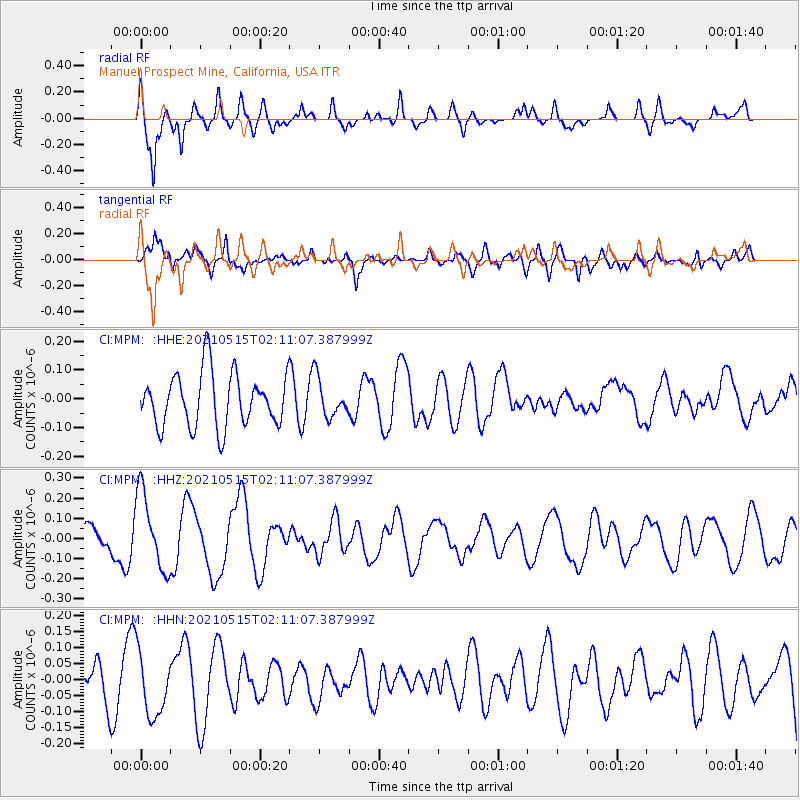
MPM Manuel Prospect Mine, California, USA - Earthquake Result Viewer
*The percent match for this event was below the threshold and hence no stack was calculated.
| Earthquake location: |
Southeast Of Loyalty Islands |
| Earthquake latitude/longitude: |
-21.8/170.1 |
| Earthquake time(UTC): |
2021/05/15 (135) 01:58:43 GMT |
| Earthquake Depth: |
20 km |
| Earthquake Magnitude: |
5.5 Mww |
| Earthquake Catalog/Contributor: |
NEIC PDE/us |
|
| Network: |
CI Caltech Regional Seismic Network |
| Station: |
MPM Manuel Prospect Mine, California, USA |
| Lat/Lon: |
36.06 N/117.49 W |
| Elevation: |
185 m |
|
| Distance: |
89.4 deg |
| Az: |
50.575 deg |
| Baz: |
242.354 deg |
| Ray Param: |
$rayparam |
*The percent match for this event was below the threshold and hence was not used in the summary stack. |
|
| Radial Match: |
76.19384 % |
| Radial Bump: |
400 |
| Transverse Match: |
66.50346 % |
| Transverse Bump: |
400 |
| SOD ConfigId: |
24890451 |
| Insert Time: |
2021-06-02 17:08:33.815 +0000 |
| GWidth: |
2.5 |
| Max Bumps: |
400 |
| Tol: |
0.001 |
|
Signal To Noise
| Channel | StoN | STA | LTA |
| CI:MPM: :HHZ:20210515T02:11:07.387999Z | 1.6802849 | 1.9230013E-7 | 1.14444966E-7 |
| CI:MPM: :HHN:20210515T02:11:07.387999Z | 1.2134008 | 9.8719994E-8 | 8.135811E-8 |
| CI:MPM: :HHE:20210515T02:11:07.387999Z | 0.7020023 | 6.5574866E-8 | 9.341119E-8 |
| Arrivals |
| Ps | |
| PpPs | |
| PsPs/PpSs | |


