You are here: Home > Network List > PF - Volcanologic Network of Piton de Fournaise-OVPF Stations List
> Station HIM cratere Himiltrude > Earthquake Result Viewer
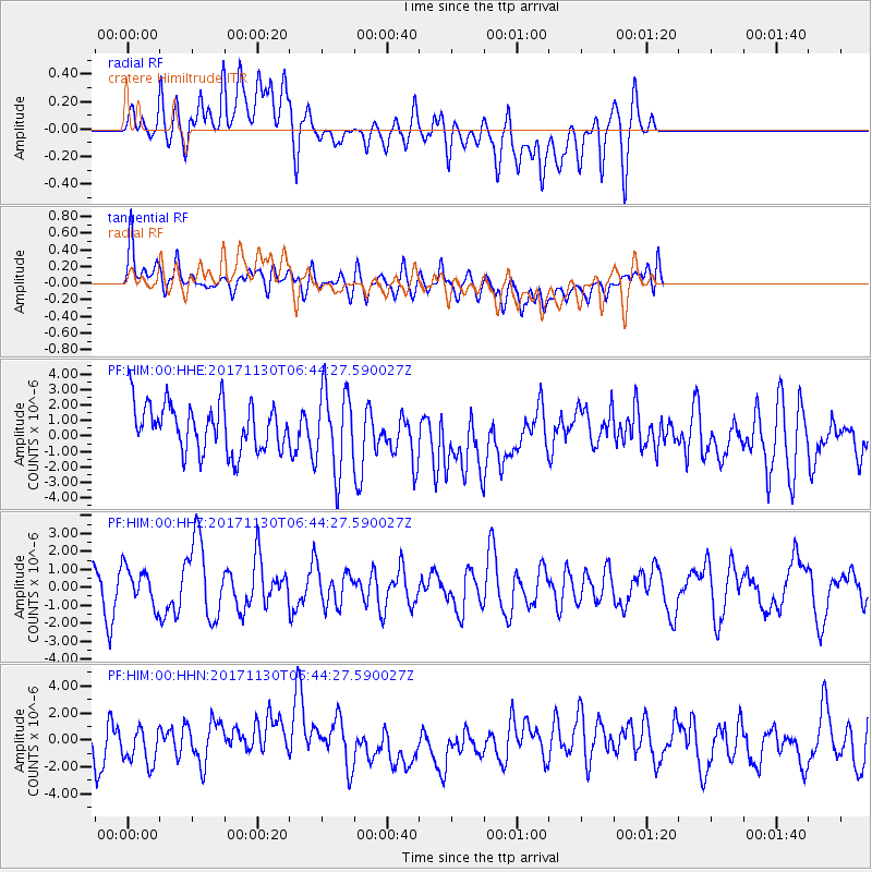
HIM cratere Himiltrude - Earthquake Result Viewer
*The percent match for this event was below the threshold and hence no stack was calculated.
| Earthquake location: |
Central Mid-Atlantic Ridge |
| Earthquake latitude/longitude: |
-1.1/-23.5 |
| Earthquake time(UTC): |
2017/11/30 (334) 06:32:52 GMT |
| Earthquake Depth: |
10 km |
| Earthquake Magnitude: |
6.5 Mi |
| Earthquake Catalog/Contributor: |
NEIC PDE/at |
|
| Network: |
PF Volcanologic Network of Piton de Fournaise-OVPF |
| Station: |
HIM cratere Himiltrude |
| Lat/Lon: |
21.21 S/55.72 E |
| Elevation: |
1958 m |
|
| Distance: |
79.6 deg |
| Az: |
111.242 deg |
| Baz: |
272.883 deg |
| Ray Param: |
$rayparam |
*The percent match for this event was below the threshold and hence was not used in the summary stack. |
|
| Radial Match: |
44.72751 % |
| Radial Bump: |
400 |
| Transverse Match: |
60.870804 % |
| Transverse Bump: |
400 |
| SOD ConfigId: |
2429771 |
| Insert Time: |
2017-12-14 06:40:09.593 +0000 |
| GWidth: |
2.5 |
| Max Bumps: |
400 |
| Tol: |
0.001 |
|
Signal To Noise
| Channel | StoN | STA | LTA |
| PF:HIM:00:HHZ:20171130T06:44:27.590027Z | 1.1127853 | 1.0239642E-6 | 9.2018115E-7 |
| PF:HIM:00:HHN:20171130T06:44:27.590027Z | 0.8830594 | 1.1820523E-6 | 1.3385875E-6 |
| PF:HIM:00:HHE:20171130T06:44:27.590027Z | 1.695501 | 2.6227435E-6 | 1.546884E-6 |
| Arrivals |
| Ps | |
| PpPs | |
| PsPs/PpSs | |


