You are here: Home > Network List > CI - Caltech Regional Seismic Network Stations List
> Station MPM Manuel Prospect Mine, California, USA > Earthquake Result Viewer
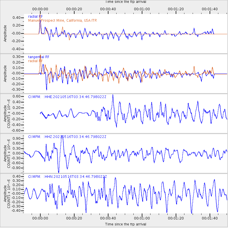
MPM Manuel Prospect Mine, California, USA - Earthquake Result Viewer
*The percent match for this event was below the threshold and hence no stack was calculated.
| Earthquake location: |
Hokkaido, Japan Region |
| Earthquake latitude/longitude: |
42.0/144.5 |
| Earthquake time(UTC): |
2021/05/16 (136) 03:23:54 GMT |
| Earthquake Depth: |
17 km |
| Earthquake Magnitude: |
5.7 mww |
| Earthquake Catalog/Contributor: |
NEIC PDE/us |
|
| Network: |
CI Caltech Regional Seismic Network |
| Station: |
MPM Manuel Prospect Mine, California, USA |
| Lat/Lon: |
36.06 N/117.49 W |
| Elevation: |
185 m |
|
| Distance: |
72.1 deg |
| Az: |
57.45 deg |
| Baz: |
309.2 deg |
| Ray Param: |
$rayparam |
*The percent match for this event was below the threshold and hence was not used in the summary stack. |
|
| Radial Match: |
72.992935 % |
| Radial Bump: |
400 |
| Transverse Match: |
78.25491 % |
| Transverse Bump: |
400 |
| SOD ConfigId: |
24890451 |
| Insert Time: |
2021-06-02 17:23:57.699 +0000 |
| GWidth: |
2.5 |
| Max Bumps: |
400 |
| Tol: |
0.001 |
|
Signal To Noise
| Channel | StoN | STA | LTA |
| CI:MPM: :HHZ:20210516T03:34:46.798022Z | 1.7239494 | 2.3476386E-7 | 1.3617793E-7 |
| CI:MPM: :HHN:20210516T03:34:46.798022Z | 1.2430195 | 8.250123E-8 | 6.637163E-8 |
| CI:MPM: :HHE:20210516T03:34:46.798022Z | 1.2804239 | 9.729289E-8 | 7.598491E-8 |
| Arrivals |
| Ps | |
| PpPs | |
| PsPs/PpSs | |


