You are here: Home > Network List > IU - Global Seismograph Network (GSN - IRIS/USGS) Stations List
> Station RSSD Black Hills, South Dakota, USA > Earthquake Result Viewer
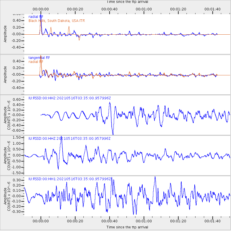
RSSD Black Hills, South Dakota, USA - Earthquake Result Viewer
*The percent match for this event was below the threshold and hence no stack was calculated.
| Earthquake location: |
Hokkaido, Japan Region |
| Earthquake latitude/longitude: |
42.0/144.5 |
| Earthquake time(UTC): |
2021/05/16 (136) 03:23:54 GMT |
| Earthquake Depth: |
17 km |
| Earthquake Magnitude: |
5.7 mww |
| Earthquake Catalog/Contributor: |
NEIC PDE/us |
|
| Network: |
IU Global Seismograph Network (GSN - IRIS/USGS) |
| Station: |
RSSD Black Hills, South Dakota, USA |
| Lat/Lon: |
44.12 N/104.04 W |
| Elevation: |
2090 m |
|
| Distance: |
74.6 deg |
| Az: |
44.046 deg |
| Baz: |
314.018 deg |
| Ray Param: |
$rayparam |
*The percent match for this event was below the threshold and hence was not used in the summary stack. |
|
| Radial Match: |
78.23643 % |
| Radial Bump: |
325 |
| Transverse Match: |
74.07303 % |
| Transverse Bump: |
400 |
| SOD ConfigId: |
24890451 |
| Insert Time: |
2021-06-02 17:29:12.075 +0000 |
| GWidth: |
2.5 |
| Max Bumps: |
400 |
| Tol: |
0.001 |
|
Signal To Noise
| Channel | StoN | STA | LTA |
| IU:RSSD:00:HHZ:20210516T03:35:00.957996Z | 4.7525325 | 2.7758583E-7 | 5.8407984E-8 |
| IU:RSSD:00:HH1:20210516T03:35:00.957996Z | 0.70606226 | 6.839654E-8 | 9.687041E-8 |
| IU:RSSD:00:HH2:20210516T03:35:00.957996Z | 1.5644324 | 1.4410918E-7 | 9.2115954E-8 |
| Arrivals |
| Ps | |
| PpPs | |
| PsPs/PpSs | |


