You are here: Home > Network List > US - United States National Seismic Network Stations List
> Station DGMT Dagmar, Montana, USA > Earthquake Result Viewer
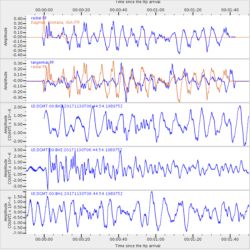
DGMT Dagmar, Montana, USA - Earthquake Result Viewer
*The percent match for this event was below the threshold and hence no stack was calculated.
| Earthquake location: |
Central Mid-Atlantic Ridge |
| Earthquake latitude/longitude: |
-1.1/-23.5 |
| Earthquake time(UTC): |
2017/11/30 (334) 06:32:52 GMT |
| Earthquake Depth: |
10 km |
| Earthquake Magnitude: |
6.5 Mi |
| Earthquake Catalog/Contributor: |
NEIC PDE/at |
|
| Network: |
US United States National Seismic Network |
| Station: |
DGMT Dagmar, Montana, USA |
| Lat/Lon: |
48.47 N/104.20 W |
| Elevation: |
0.0 m |
|
| Distance: |
84.6 deg |
| Az: |
318.729 deg |
| Baz: |
97.697 deg |
| Ray Param: |
$rayparam |
*The percent match for this event was below the threshold and hence was not used in the summary stack. |
|
| Radial Match: |
50.480648 % |
| Radial Bump: |
381 |
| Transverse Match: |
50.019634 % |
| Transverse Bump: |
383 |
| SOD ConfigId: |
2429771 |
| Insert Time: |
2017-12-14 06:42:04.366 +0000 |
| GWidth: |
2.5 |
| Max Bumps: |
400 |
| Tol: |
0.001 |
|
Signal To Noise
| Channel | StoN | STA | LTA |
| US:DGMT:00:BHZ:20171130T06:44:54.198975Z | 4.0185223 | 1.4880892E-6 | 3.7030753E-7 |
| US:DGMT:00:BH1:20171130T06:44:54.198975Z | 1.06263 | 8.733254E-7 | 8.218527E-7 |
| US:DGMT:00:BH2:20171130T06:44:54.198975Z | 0.9339572 | 9.2792567E-7 | 9.935419E-7 |
| Arrivals |
| Ps | |
| PpPs | |
| PsPs/PpSs | |


