You are here: Home > Network List > US - United States National Seismic Network Stations List
> Station DGMT Dagmar, Montana, USA > Earthquake Result Viewer
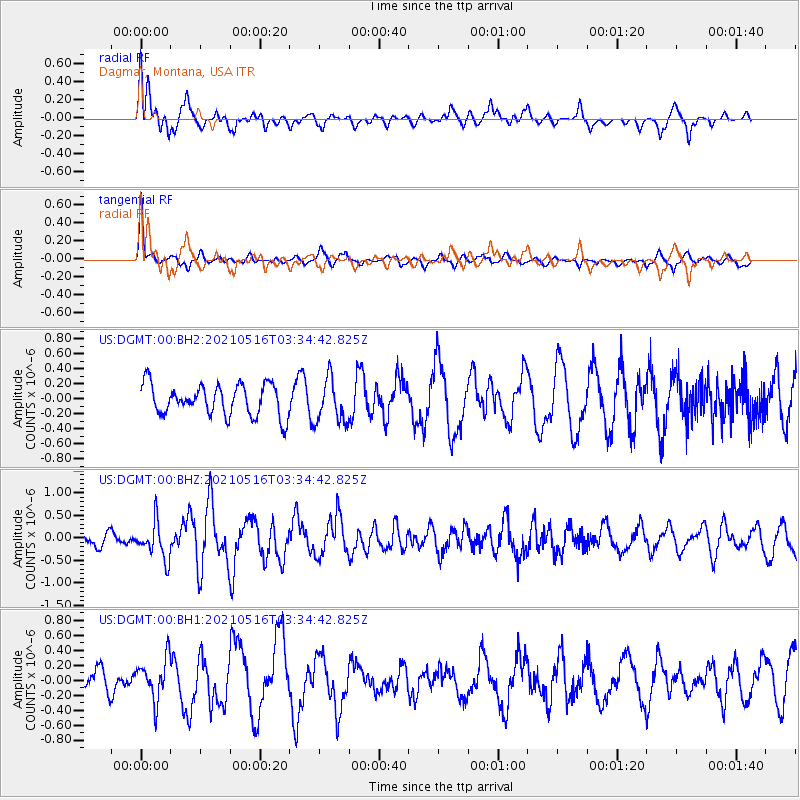
DGMT Dagmar, Montana, USA - Earthquake Result Viewer
*The percent match for this event was below the threshold and hence no stack was calculated.
| Earthquake location: |
Hokkaido, Japan Region |
| Earthquake latitude/longitude: |
42.0/144.5 |
| Earthquake time(UTC): |
2021/05/16 (136) 03:23:54 GMT |
| Earthquake Depth: |
17 km |
| Earthquake Magnitude: |
5.7 mww |
| Earthquake Catalog/Contributor: |
NEIC PDE/us |
|
| Network: |
US United States National Seismic Network |
| Station: |
DGMT Dagmar, Montana, USA |
| Lat/Lon: |
48.47 N/104.20 W |
| Elevation: |
0.0 m |
|
| Distance: |
71.5 deg |
| Az: |
40.826 deg |
| Baz: |
312.962 deg |
| Ray Param: |
$rayparam |
*The percent match for this event was below the threshold and hence was not used in the summary stack. |
|
| Radial Match: |
72.10023 % |
| Radial Bump: |
400 |
| Transverse Match: |
79.53474 % |
| Transverse Bump: |
343 |
| SOD ConfigId: |
24890451 |
| Insert Time: |
2021-06-02 17:41:42.561 +0000 |
| GWidth: |
2.5 |
| Max Bumps: |
400 |
| Tol: |
0.001 |
|
Signal To Noise
| Channel | StoN | STA | LTA |
| US:DGMT:00:BHZ:20210516T03:34:42.825Z | 3.1232097 | 4.0450755E-7 | 1.2951661E-7 |
| US:DGMT:00:BH1:20210516T03:34:42.825Z | 1.8996557 | 2.7764847E-7 | 1.4615726E-7 |
| US:DGMT:00:BH2:20210516T03:34:42.825Z | 1.4135274 | 2.9073655E-7 | 2.0568159E-7 |
| Arrivals |
| Ps | |
| PpPs | |
| PsPs/PpSs | |


