You are here: Home > Network List > UW - Pacific Northwest Regional Seismic Network Stations List
> Station IRON Crane, OR, USA > Earthquake Result Viewer
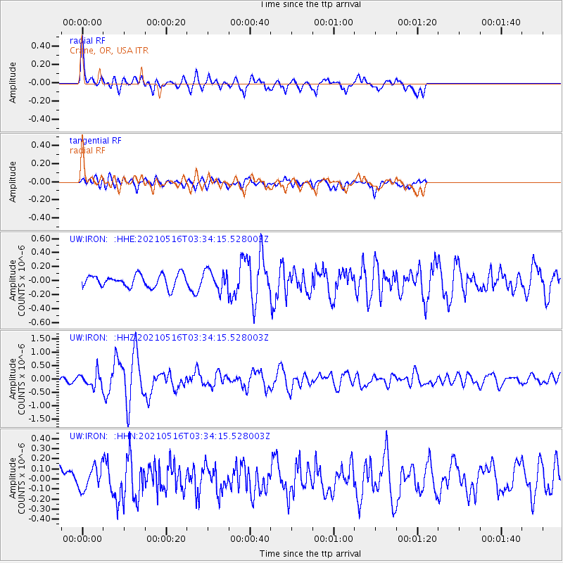
IRON Crane, OR, USA - Earthquake Result Viewer
*The percent match for this event was below the threshold and hence no stack was calculated.
| Earthquake location: |
Hokkaido, Japan Region |
| Earthquake latitude/longitude: |
42.0/144.5 |
| Earthquake time(UTC): |
2021/05/16 (136) 03:23:54 GMT |
| Earthquake Depth: |
17 km |
| Earthquake Magnitude: |
5.7 mww |
| Earthquake Catalog/Contributor: |
NEIC PDE/us |
|
| Network: |
UW Pacific Northwest Regional Seismic Network |
| Station: |
IRON Crane, OR, USA |
| Lat/Lon: |
43.36 N/118.47 W |
| Elevation: |
1226 m |
|
| Distance: |
67.1 deg |
| Az: |
51.813 deg |
| Baz: |
306.604 deg |
| Ray Param: |
$rayparam |
*The percent match for this event was below the threshold and hence was not used in the summary stack. |
|
| Radial Match: |
74.59716 % |
| Radial Bump: |
400 |
| Transverse Match: |
65.13417 % |
| Transverse Bump: |
400 |
| SOD ConfigId: |
24890451 |
| Insert Time: |
2021-06-02 17:43:38.905 +0000 |
| GWidth: |
2.5 |
| Max Bumps: |
400 |
| Tol: |
0.001 |
|
Signal To Noise
| Channel | StoN | STA | LTA |
| UW:IRON: :HHZ:20210516T03:34:15.528003Z | 3.1825895 | 2.7437048E-7 | 8.620982E-8 |
| UW:IRON: :HHN:20210516T03:34:15.528003Z | 1.3739303 | 1.14244315E-7 | 8.315147E-8 |
| UW:IRON: :HHE:20210516T03:34:15.528003Z | 1.5544243 | 1.4032196E-7 | 9.027263E-8 |
| Arrivals |
| Ps | |
| PpPs | |
| PsPs/PpSs | |


