You are here: Home > Network List > WY - Yellowstone Wyoming Seismic Network Stations List
> Station YHH Holmes Hill, YNP, WY, USA > Earthquake Result Viewer
YHH Holmes Hill, YNP, WY, USA - Earthquake Result Viewer
*The percent match for this event was below the threshold and hence no stack was calculated.
| Earthquake location: |
Hokkaido, Japan Region |
| Earthquake latitude/longitude: |
42.0/144.5 |
| Earthquake time(UTC): |
2021/05/16 (136) 03:23:54 GMT |
| Earthquake Depth: |
17 km |
| Earthquake Magnitude: |
5.7 mww |
| Earthquake Catalog/Contributor: |
NEIC PDE/us |
|
| Network: |
WY Yellowstone Wyoming Seismic Network |
| Station: |
YHH Holmes Hill, YNP, WY, USA |
| Lat/Lon: |
44.79 N/110.85 W |
| Elevation: |
2717 m |
|
| Distance: |
70.5 deg |
| Az: |
46.955 deg |
| Baz: |
310.133 deg |
| Ray Param: |
$rayparam |
*The percent match for this event was below the threshold and hence was not used in the summary stack. |
|
| Radial Match: |
73.54416 % |
| Radial Bump: |
400 |
| Transverse Match: |
74.02524 % |
| Transverse Bump: |
400 |
| SOD ConfigId: |
24890451 |
| Insert Time: |
2021-06-02 17:45:04.973 +0000 |
| GWidth: |
2.5 |
| Max Bumps: |
400 |
| Tol: |
0.001 |
|
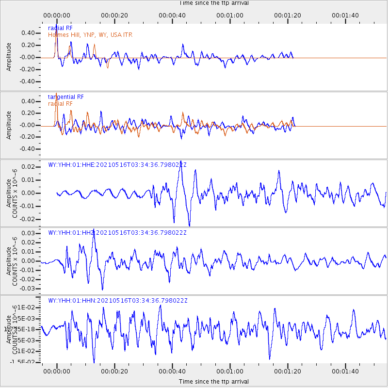
Signal To Noise
| Channel | StoN | STA | LTA |
| WY:YHH:01:HHZ:20210516T03:34:36.798022Z | 2.8844151 | 5.817183E-9 | 2.0167634E-9 |
| WY:YHH:01:HHN:20210516T03:34:36.798022Z | 1.7690864 | 3.150659E-9 | 1.7809527E-9 |
| WY:YHH:01:HHE:20210516T03:34:36.798022Z | 1.7935131 | 3.5002532E-9 | 1.9516184E-9 |
| Arrivals |
| Ps | |
| PpPs | |
| PsPs/PpSs | |


