You are here: Home > Network List > AZ - ANZA Regional Network Stations List
> Station SMER AZ.SMER > Earthquake Result Viewer
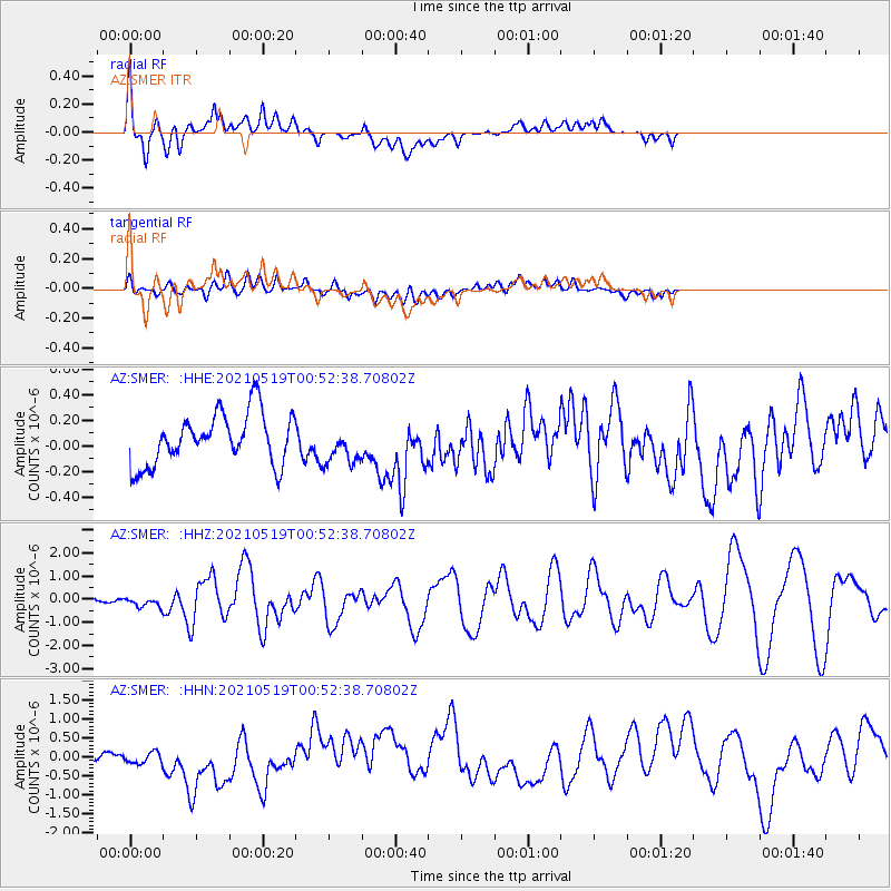
SMER AZ.SMER - Earthquake Result Viewer
*The percent match for this event was below the threshold and hence no stack was calculated.
| Earthquake location: |
Southern East Pacific Rise |
| Earthquake latitude/longitude: |
-33.1/-109.4 |
| Earthquake time(UTC): |
2021/05/19 (139) 00:42:19 GMT |
| Earthquake Depth: |
10 km |
| Earthquake Magnitude: |
6.7 mww |
| Earthquake Catalog/Contributor: |
NEIC PDE/us |
|
| Network: |
AZ ANZA Regional Network |
| Station: |
SMER AZ.SMER |
| Lat/Lon: |
33.46 N/117.17 W |
| Elevation: |
355 m |
|
| Distance: |
66.6 deg |
| Az: |
352.919 deg |
| Baz: |
172.887 deg |
| Ray Param: |
$rayparam |
*The percent match for this event was below the threshold and hence was not used in the summary stack. |
|
| Radial Match: |
65.87847 % |
| Radial Bump: |
400 |
| Transverse Match: |
55.04397 % |
| Transverse Bump: |
400 |
| SOD ConfigId: |
24890451 |
| Insert Time: |
2021-06-02 18:03:27.741 +0000 |
| GWidth: |
2.5 |
| Max Bumps: |
400 |
| Tol: |
0.001 |
|
Signal To Noise
| Channel | StoN | STA | LTA |
| AZ:SMER: :HHZ:20210519T00:52:38.70802Z | 2.0820973 | 1.8994855E-7 | 9.122944E-8 |
| AZ:SMER: :HHN:20210519T00:52:38.70802Z | 2.512371 | 3.0090158E-7 | 1.1976798E-7 |
| AZ:SMER: :HHE:20210519T00:52:38.70802Z | 0.7412739 | 1.4825788E-7 | 2.000042E-7 |
| Arrivals |
| Ps | |
| PpPs | |
| PsPs/PpSs | |


