You are here: Home > Network List > CI - Caltech Regional Seismic Network Stations List
> Station SWS Sam W. Stewart, Westmorland, CA, USA > Earthquake Result Viewer
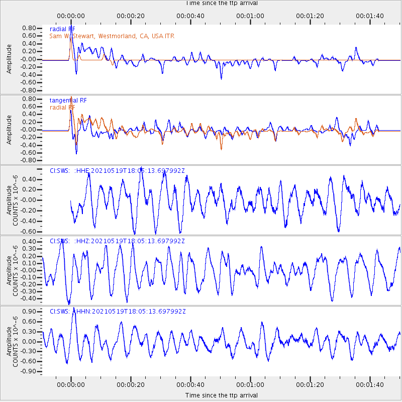
SWS Sam W. Stewart, Westmorland, CA, USA - Earthquake Result Viewer
*The percent match for this event was below the threshold and hence no stack was calculated.
| Earthquake location: |
Southern East Pacific Rise |
| Earthquake latitude/longitude: |
-36.8/-110.4 |
| Earthquake time(UTC): |
2021/05/19 (139) 17:54:36 GMT |
| Earthquake Depth: |
10 km |
| Earthquake Magnitude: |
5.1 mb |
| Earthquake Catalog/Contributor: |
NEIC PDE/us |
|
| Network: |
CI Caltech Regional Seismic Network |
| Station: |
SWS Sam W. Stewart, Westmorland, CA, USA |
| Lat/Lon: |
32.94 N/115.80 W |
| Elevation: |
140 m |
|
| Distance: |
69.5 deg |
| Az: |
355.131 deg |
| Baz: |
175.35 deg |
| Ray Param: |
$rayparam |
*The percent match for this event was below the threshold and hence was not used in the summary stack. |
|
| Radial Match: |
65.464554 % |
| Radial Bump: |
400 |
| Transverse Match: |
71.497116 % |
| Transverse Bump: |
400 |
| SOD ConfigId: |
24890451 |
| Insert Time: |
2021-06-02 18:34:40.204 +0000 |
| GWidth: |
2.5 |
| Max Bumps: |
400 |
| Tol: |
0.001 |
|
Signal To Noise
| Channel | StoN | STA | LTA |
| CI:SWS: :HHZ:20210519T18:05:13.697992Z | 1.261469 | 2.3368318E-7 | 1.8524688E-7 |
| CI:SWS: :HHN:20210519T18:05:13.697992Z | 2.1636279 | 5.2524814E-7 | 2.427627E-7 |
| CI:SWS: :HHE:20210519T18:05:13.697992Z | 1.0154752 | 2.8968978E-7 | 2.852751E-7 |
| Arrivals |
| Ps | |
| PpPs | |
| PsPs/PpSs | |


