You are here: Home > Network List > UW - Pacific Northwest Regional Seismic Network Stations List
> Station UMAT Pilot Rock, OR, USA > Earthquake Result Viewer
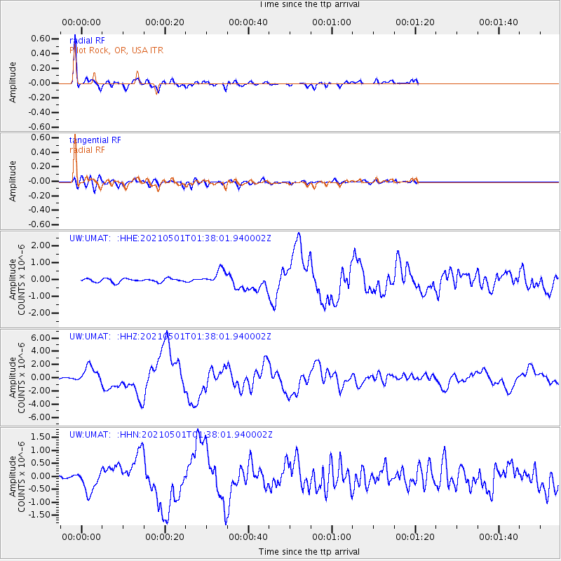
UMAT Pilot Rock, OR, USA - Earthquake Result Viewer
*The percent match for this event was below the threshold and hence no stack was calculated.
| Earthquake location: |
Near East Coast Of Honshu, Japan |
| Earthquake latitude/longitude: |
38.1/141.8 |
| Earthquake time(UTC): |
2021/05/01 (121) 01:27:30 GMT |
| Earthquake Depth: |
56 km |
| Earthquake Magnitude: |
6.6 Mi |
| Earthquake Catalog/Contributor: |
NEIC PDE/at |
|
| Network: |
UW Pacific Northwest Regional Seismic Network |
| Station: |
UMAT Pilot Rock, OR, USA |
| Lat/Lon: |
45.29 N/118.96 W |
| Elevation: |
1318 m |
|
| Distance: |
69.8 deg |
| Az: |
47.949 deg |
| Baz: |
303.911 deg |
| Ray Param: |
$rayparam |
*The percent match for this event was below the threshold and hence was not used in the summary stack. |
|
| Radial Match: |
95.49036 % |
| Radial Bump: |
326 |
| Transverse Match: |
80.178 % |
| Transverse Bump: |
400 |
| SOD ConfigId: |
25028951 |
| Insert Time: |
2021-06-02 22:55:50.192 +0000 |
| GWidth: |
2.5 |
| Max Bumps: |
400 |
| Tol: |
0.001 |
|
Signal To Noise
| Channel | StoN | STA | LTA |
| UW:UMAT: :HHZ:20210501T01:38:01.940002Z | 13.988423 | 1.340603E-6 | 9.5836604E-8 |
| UW:UMAT: :HHN:20210501T01:38:01.940002Z | 6.2053385 | 4.3317615E-7 | 6.9807015E-8 |
| UW:UMAT: :HHE:20210501T01:38:01.940002Z | 4.468572 | 4.7212316E-7 | 1.0565415E-7 |
| Arrivals |
| Ps | |
| PpPs | |
| PsPs/PpSs | |


