You are here: Home > Network List > IU - Global Seismograph Network (GSN - IRIS/USGS) Stations List
> Station PMG Port Moresby, New Guinea > Earthquake Result Viewer
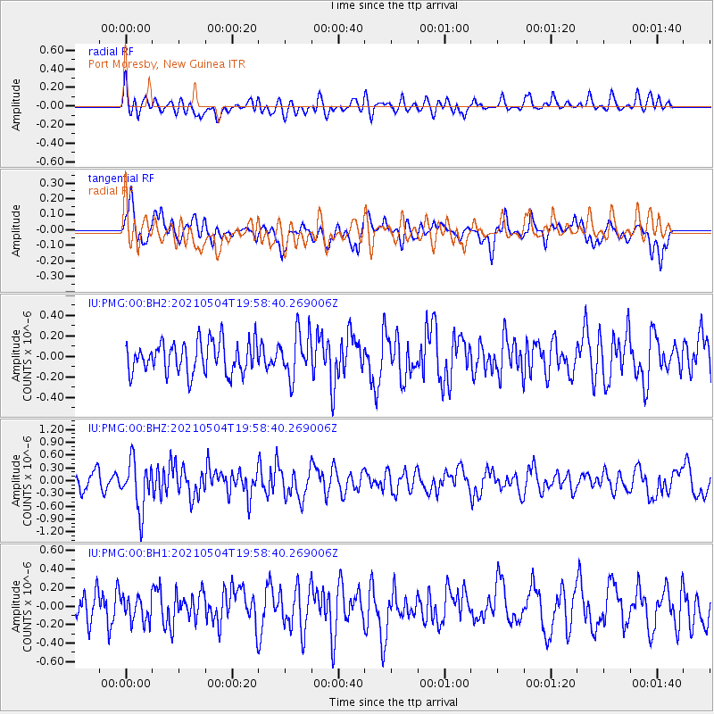
PMG Port Moresby, New Guinea - Earthquake Result Viewer
*The percent match for this event was below the threshold and hence no stack was calculated.
| Earthquake location: |
Tonga Islands |
| Earthquake latitude/longitude: |
-20.7/-173.8 |
| Earthquake time(UTC): |
2021/05/04 (124) 19:51:42 GMT |
| Earthquake Depth: |
10 km |
| Earthquake Magnitude: |
5.5 mww |
| Earthquake Catalog/Contributor: |
NEIC PDE/us |
|
| Network: |
IU Global Seismograph Network (GSN - IRIS/USGS) |
| Station: |
PMG Port Moresby, New Guinea |
| Lat/Lon: |
9.40 S/147.16 E |
| Elevation: |
90 m |
|
| Distance: |
39.3 deg |
| Az: |
280.717 deg |
| Baz: |
111.243 deg |
| Ray Param: |
$rayparam |
*The percent match for this event was below the threshold and hence was not used in the summary stack. |
|
| Radial Match: |
59.916744 % |
| Radial Bump: |
400 |
| Transverse Match: |
48.14678 % |
| Transverse Bump: |
400 |
| SOD ConfigId: |
25028951 |
| Insert Time: |
2021-06-02 23:29:47.587 +0000 |
| GWidth: |
2.5 |
| Max Bumps: |
400 |
| Tol: |
0.001 |
|
Signal To Noise
| Channel | StoN | STA | LTA |
| IU:PMG:00:BHZ:20210504T19:58:40.269006Z | 2.5768535 | 5.745411E-7 | 2.2296229E-7 |
| IU:PMG:00:BH1:20210504T19:58:40.269006Z | 0.96048576 | 1.3074775E-7 | 1.3612669E-7 |
| IU:PMG:00:BH2:20210504T19:58:40.269006Z | 1.4372467 | 2.1982096E-7 | 1.5294589E-7 |
| Arrivals |
| Ps | |
| PpPs | |
| PsPs/PpSs | |


