You are here: Home > Network List > IU - Global Seismograph Network (GSN - IRIS/USGS) Stations List
> Station JOHN Johnston Island, USA > Earthquake Result Viewer
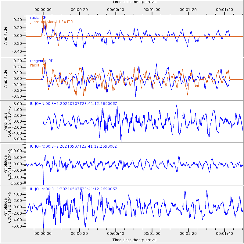
JOHN Johnston Island, USA - Earthquake Result Viewer
*The percent match for this event was below the threshold and hence no stack was calculated.
| Earthquake location: |
Fiji Islands Region |
| Earthquake latitude/longitude: |
-18.8/-177.5 |
| Earthquake time(UTC): |
2021/05/07 (127) 23:35:14 GMT |
| Earthquake Depth: |
384 km |
| Earthquake Magnitude: |
6.1 Mww |
| Earthquake Catalog/Contributor: |
NEIC PDE/us |
|
| Network: |
IU Global Seismograph Network (GSN - IRIS/USGS) |
| Station: |
JOHN Johnston Island, USA |
| Lat/Lon: |
16.73 N/169.53 W |
| Elevation: |
2.0 m |
|
| Distance: |
36.2 deg |
| Az: |
12.988 deg |
| Baz: |
192.837 deg |
| Ray Param: |
$rayparam |
*The percent match for this event was below the threshold and hence was not used in the summary stack. |
|
| Radial Match: |
57.9452 % |
| Radial Bump: |
400 |
| Transverse Match: |
49.61747 % |
| Transverse Bump: |
400 |
| SOD ConfigId: |
25028951 |
| Insert Time: |
2021-06-03 00:00:35.826 +0000 |
| GWidth: |
2.5 |
| Max Bumps: |
400 |
| Tol: |
0.001 |
|
Signal To Noise
| Channel | StoN | STA | LTA |
| IU:JOHN:00:BHZ:20210507T23:41:12.269006Z | 3.3209271 | 4.628498E-6 | 1.3937367E-6 |
| IU:JOHN:00:BH1:20210507T23:41:12.269006Z | 1.8190571 | 2.5450636E-6 | 1.3991114E-6 |
| IU:JOHN:00:BH2:20210507T23:41:12.269006Z | 1.9170326 | 2.4435162E-6 | 1.2746347E-6 |
| Arrivals |
| Ps | |
| PpPs | |
| PsPs/PpSs | |


