You are here: Home > Network List > UW - Pacific Northwest Regional Seismic Network Stations List
> Station UMAT Pilot Rock, OR, USA > Earthquake Result Viewer
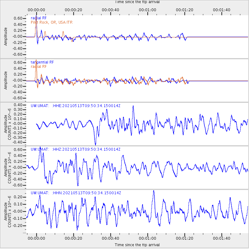
UMAT Pilot Rock, OR, USA - Earthquake Result Viewer
*The percent match for this event was below the threshold and hence no stack was calculated.
| Earthquake location: |
South Of Panama |
| Earthquake latitude/longitude: |
6.8/-82.4 |
| Earthquake time(UTC): |
2021/05/13 (133) 09:42:12 GMT |
| Earthquake Depth: |
10 km |
| Earthquake Magnitude: |
6.0 mww |
| Earthquake Catalog/Contributor: |
NEIC PDE/us |
|
| Network: |
UW Pacific Northwest Regional Seismic Network |
| Station: |
UMAT Pilot Rock, OR, USA |
| Lat/Lon: |
45.29 N/118.96 W |
| Elevation: |
1318 m |
|
| Distance: |
49.8 deg |
| Az: |
326.573 deg |
| Baz: |
129.191 deg |
| Ray Param: |
$rayparam |
*The percent match for this event was below the threshold and hence was not used in the summary stack. |
|
| Radial Match: |
68.65675 % |
| Radial Bump: |
339 |
| Transverse Match: |
68.536865 % |
| Transverse Bump: |
358 |
| SOD ConfigId: |
25028951 |
| Insert Time: |
2021-06-03 01:16:20.385 +0000 |
| GWidth: |
2.5 |
| Max Bumps: |
400 |
| Tol: |
0.001 |
|
Signal To Noise
| Channel | StoN | STA | LTA |
| UW:UMAT: :HHZ:20210513T09:50:34.150014Z | 5.989073 | 3.360861E-7 | 5.611655E-8 |
| UW:UMAT: :HHN:20210513T09:50:34.150014Z | 1.5932704 | 9.890006E-8 | 6.207362E-8 |
| UW:UMAT: :HHE:20210513T09:50:34.150014Z | 3.715616 | 1.9356914E-7 | 5.209611E-8 |
| Arrivals |
| Ps | |
| PpPs | |
| PsPs/PpSs | |


