You are here: Home > Network List > G - GEOSCOPE Stations List
> Station WUS Wushi, Xinjiang Uygur, China > Earthquake Result Viewer
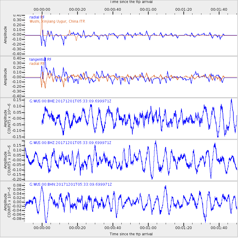
WUS Wushi, Xinjiang Uygur, China - Earthquake Result Viewer
*The percent match for this event was below the threshold and hence no stack was calculated.
| Earthquake location: |
Southeast Indian Ridge |
| Earthquake latitude/longitude: |
-48.8/106.8 |
| Earthquake time(UTC): |
2017/12/01 (335) 05:20:28 GMT |
| Earthquake Depth: |
10 km |
| Earthquake Magnitude: |
5.5 Mww |
| Earthquake Catalog/Contributor: |
NEIC PDE/us |
|
| Network: |
G GEOSCOPE |
| Station: |
WUS Wushi, Xinjiang Uygur, China |
| Lat/Lon: |
41.20 N/79.22 E |
| Elevation: |
1457 m |
|
| Distance: |
92.9 deg |
| Az: |
339.505 deg |
| Baz: |
162.127 deg |
| Ray Param: |
$rayparam |
*The percent match for this event was below the threshold and hence was not used in the summary stack. |
|
| Radial Match: |
51.514614 % |
| Radial Bump: |
400 |
| Transverse Match: |
58.49341 % |
| Transverse Bump: |
400 |
| SOD ConfigId: |
2429771 |
| Insert Time: |
2017-12-15 13:00:18.103 +0000 |
| GWidth: |
2.5 |
| Max Bumps: |
400 |
| Tol: |
0.001 |
|
Signal To Noise
| Channel | StoN | STA | LTA |
| G:WUS:00:BHZ:20171201T05:33:09.699971Z | 1.2316957 | 6.088153E-8 | 4.9429037E-8 |
| G:WUS:00:BHN:20171201T05:33:09.699971Z | 2.152274 | 5.6555876E-8 | 2.6277268E-8 |
| G:WUS:00:BHE:20171201T05:33:09.699971Z | 1.4639667 | 6.665074E-8 | 4.55275E-8 |
| Arrivals |
| Ps | |
| PpPs | |
| PsPs/PpSs | |


