You are here: Home > Network List > PF - Volcanologic Network of Piton de Fournaise-OVPF Stations List
> Station GPS Grandes Pentes Sud > Earthquake Result Viewer
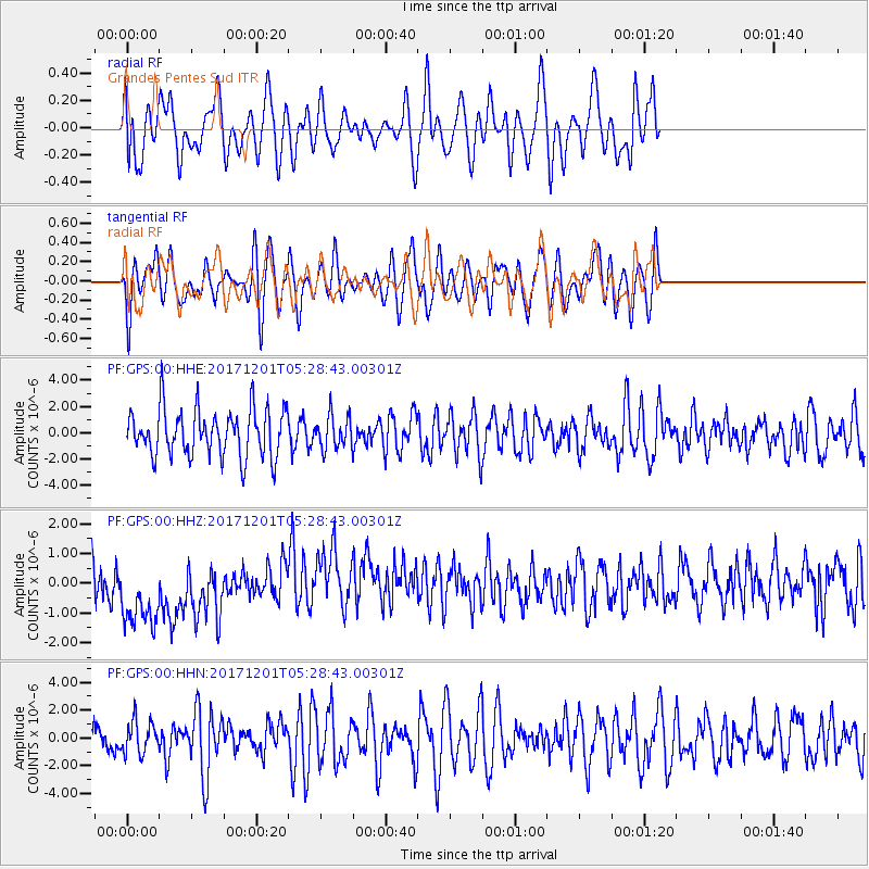
GPS Grandes Pentes Sud - Earthquake Result Viewer
*The percent match for this event was below the threshold and hence no stack was calculated.
| Earthquake location: |
Southeast Indian Ridge |
| Earthquake latitude/longitude: |
-48.8/106.8 |
| Earthquake time(UTC): |
2017/12/01 (335) 05:20:28 GMT |
| Earthquake Depth: |
10 km |
| Earthquake Magnitude: |
5.5 Mww |
| Earthquake Catalog/Contributor: |
NEIC PDE/us |
|
| Network: |
PF Volcanologic Network of Piton de Fournaise-OVPF |
| Station: |
GPS Grandes Pentes Sud |
| Lat/Lon: |
21.27 S/55.76 E |
| Elevation: |
1004 m |
|
| Distance: |
48.8 deg |
| Az: |
285.491 deg |
| Baz: |
136.888 deg |
| Ray Param: |
$rayparam |
*The percent match for this event was below the threshold and hence was not used in the summary stack. |
|
| Radial Match: |
55.263325 % |
| Radial Bump: |
400 |
| Transverse Match: |
52.644 % |
| Transverse Bump: |
400 |
| SOD ConfigId: |
2429771 |
| Insert Time: |
2017-12-15 13:01:48.833 +0000 |
| GWidth: |
2.5 |
| Max Bumps: |
400 |
| Tol: |
0.001 |
|
Signal To Noise
| Channel | StoN | STA | LTA |
| PF:GPS:00:HHZ:20171201T05:28:43.00301Z | 2.0185983 | 1.6265224E-6 | 8.0576825E-7 |
| PF:GPS:00:HHN:20171201T05:28:43.00301Z | 0.83921784 | 1.1569513E-6 | 1.3786066E-6 |
| PF:GPS:00:HHE:20171201T05:28:43.00301Z | 0.66909426 | 1.2024025E-6 | 1.7970598E-6 |
| Arrivals |
| Ps | |
| PpPs | |
| PsPs/PpSs | |


