You are here: Home > Network List > TA - USArray Transportable Network (new EarthScope stations) Stations List
> Station A36M Sachs Harbour, NT, CAN > Earthquake Result Viewer
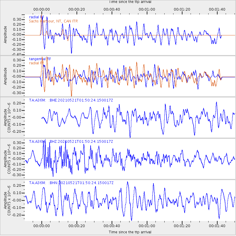
A36M Sachs Harbour, NT, CAN - Earthquake Result Viewer
*The percent match for this event was below the threshold and hence no stack was calculated.
| Earthquake location: |
Solomon Islands |
| Earthquake latitude/longitude: |
-9.9/160.4 |
| Earthquake time(UTC): |
2021/05/21 (141) 01:37:36 GMT |
| Earthquake Depth: |
16 km |
| Earthquake Magnitude: |
5.4 Mww |
| Earthquake Catalog/Contributor: |
NEIC PDE/us |
|
| Network: |
TA USArray Transportable Network (new EarthScope stations) |
| Station: |
A36M Sachs Harbour, NT, CAN |
| Lat/Lon: |
71.99 N/125.25 W |
| Elevation: |
32 m |
|
| Distance: |
94.6 deg |
| Az: |
17.486 deg |
| Baz: |
252.097 deg |
| Ray Param: |
$rayparam |
*The percent match for this event was below the threshold and hence was not used in the summary stack. |
|
| Radial Match: |
64.60501 % |
| Radial Bump: |
400 |
| Transverse Match: |
49.688885 % |
| Transverse Bump: |
400 |
| SOD ConfigId: |
25028951 |
| Insert Time: |
2021-06-04 01:48:17.098 +0000 |
| GWidth: |
2.5 |
| Max Bumps: |
400 |
| Tol: |
0.001 |
|
Signal To Noise
| Channel | StoN | STA | LTA |
| TA:A36M: :BHZ:20210521T01:50:24.150017Z | 2.7180784 | 1.5539149E-7 | 5.7169615E-8 |
| TA:A36M: :BHN:20210521T01:50:24.150017Z | 1.8159243 | 1.10953934E-7 | 6.110053E-8 |
| TA:A36M: :BHE:20210521T01:50:24.150017Z | 1.6975551 | 1.0431539E-7 | 6.1450365E-8 |
| Arrivals |
| Ps | |
| PpPs | |
| PsPs/PpSs | |


