You are here: Home > Network List > UW - Pacific Northwest Regional Seismic Network Stations List
> Station IRON Crane, OR, USA > Earthquake Result Viewer
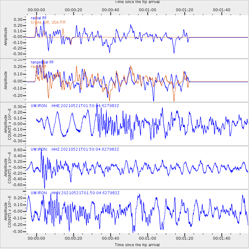
IRON Crane, OR, USA - Earthquake Result Viewer
*The percent match for this event was below the threshold and hence no stack was calculated.
| Earthquake location: |
Solomon Islands |
| Earthquake latitude/longitude: |
-9.9/160.4 |
| Earthquake time(UTC): |
2021/05/21 (141) 01:37:36 GMT |
| Earthquake Depth: |
16 km |
| Earthquake Magnitude: |
5.4 Mww |
| Earthquake Catalog/Contributor: |
NEIC PDE/us |
|
| Network: |
UW Pacific Northwest Regional Seismic Network |
| Station: |
IRON Crane, OR, USA |
| Lat/Lon: |
43.36 N/118.47 W |
| Elevation: |
1226 m |
|
| Distance: |
90.3 deg |
| Az: |
46.101 deg |
| Baz: |
256.753 deg |
| Ray Param: |
$rayparam |
*The percent match for this event was below the threshold and hence was not used in the summary stack. |
|
| Radial Match: |
53.002213 % |
| Radial Bump: |
400 |
| Transverse Match: |
52.253025 % |
| Transverse Bump: |
400 |
| SOD ConfigId: |
25028951 |
| Insert Time: |
2021-06-04 01:50:12.276 +0000 |
| GWidth: |
2.5 |
| Max Bumps: |
400 |
| Tol: |
0.001 |
|
Signal To Noise
| Channel | StoN | STA | LTA |
| UW:IRON: :HHZ:20210521T01:50:04.627983Z | 2.6384315 | 2.7452433E-7 | 1.04048304E-7 |
| UW:IRON: :HHN:20210521T01:50:04.627983Z | 1.4390765 | 1.03064004E-7 | 7.161815E-8 |
| UW:IRON: :HHE:20210521T01:50:04.627983Z | 1.3174598 | 1.517114E-7 | 1.1515448E-7 |
| Arrivals |
| Ps | |
| PpPs | |
| PsPs/PpSs | |


