You are here: Home > Network List > AV - Alaska Volcano Observatory Stations List
> Station MAPS Pakushin Southeast, Makushin Volcano, Alaska > Earthquake Result Viewer
MAPS Pakushin Southeast, Makushin Volcano, Alaska - Earthquake Result Viewer
*The percent match for this event was below the threshold and hence no stack was calculated.
| Earthquake location: |
Java, Indonesia |
| Earthquake latitude/longitude: |
-8.4/112.4 |
| Earthquake time(UTC): |
2021/05/21 (141) 12:09:22 GMT |
| Earthquake Depth: |
108 km |
| Earthquake Magnitude: |
5.7 Mww |
| Earthquake Catalog/Contributor: |
NEIC PDE/us |
|
| Network: |
AV Alaska Volcano Observatory |
| Station: |
MAPS Pakushin Southeast, Makushin Volcano, Alaska |
| Lat/Lon: |
53.81 N/166.94 W |
| Elevation: |
333 m |
|
| Distance: |
91.3 deg |
| Az: |
35.832 deg |
| Baz: |
257.593 deg |
| Ray Param: |
$rayparam |
*The percent match for this event was below the threshold and hence was not used in the summary stack. |
|
| Radial Match: |
62.459827 % |
| Radial Bump: |
400 |
| Transverse Match: |
79.20624 % |
| Transverse Bump: |
400 |
| SOD ConfigId: |
25028951 |
| Insert Time: |
2021-06-04 12:11:03.210 +0000 |
| GWidth: |
2.5 |
| Max Bumps: |
400 |
| Tol: |
0.001 |
|
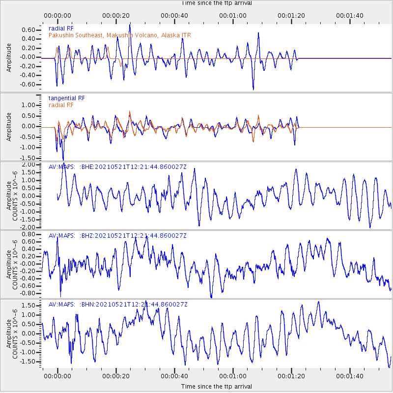
Signal To Noise
| Channel | StoN | STA | LTA |
| AV:MAPS: :BHZ:20210521T12:21:44.860027Z | 0.96014875 | 3.348354E-7 | 3.487328E-7 |
| AV:MAPS: :BHN:20210521T12:21:44.860027Z | 0.9225845 | 6.319664E-7 | 6.849957E-7 |
| AV:MAPS: :BHE:20210521T12:21:44.860027Z | 0.9538775 | 5.959616E-7 | 6.247779E-7 |
| Arrivals |
| Ps | |
| PpPs | |
| PsPs/PpSs | |


