You are here: Home > Network List > G - GEOSCOPE Stations List
> Station FOMA Nahampoana reservation, Fort Dauphin, Madagascar > Earthquake Result Viewer
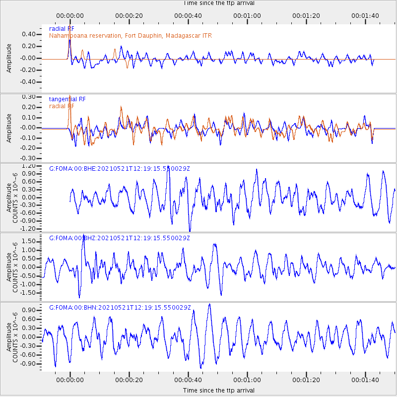
FOMA Nahampoana reservation, Fort Dauphin, Madagascar - Earthquake Result Viewer
*The percent match for this event was below the threshold and hence no stack was calculated.
| Earthquake location: |
Java, Indonesia |
| Earthquake latitude/longitude: |
-8.4/112.4 |
| Earthquake time(UTC): |
2021/05/21 (141) 12:09:22 GMT |
| Earthquake Depth: |
108 km |
| Earthquake Magnitude: |
5.7 Mww |
| Earthquake Catalog/Contributor: |
NEIC PDE/us |
|
| Network: |
G GEOSCOPE |
| Station: |
FOMA Nahampoana reservation, Fort Dauphin, Madagascar |
| Lat/Lon: |
24.98 S/46.98 E |
| Elevation: |
26 m |
|
| Distance: |
64.2 deg |
| Az: |
246.391 deg |
| Baz: |
87.365 deg |
| Ray Param: |
$rayparam |
*The percent match for this event was below the threshold and hence was not used in the summary stack. |
|
| Radial Match: |
48.20622 % |
| Radial Bump: |
400 |
| Transverse Match: |
57.705166 % |
| Transverse Bump: |
400 |
| SOD ConfigId: |
25028951 |
| Insert Time: |
2021-06-04 12:11:35.387 +0000 |
| GWidth: |
2.5 |
| Max Bumps: |
400 |
| Tol: |
0.001 |
|
Signal To Noise
| Channel | StoN | STA | LTA |
| G:FOMA:00:BHZ:20210521T12:19:15.550029Z | 1.9597017 | 8.634863E-7 | 4.4062133E-7 |
| G:FOMA:00:BHN:20210521T12:19:15.550029Z | 1.6182472 | 4.3513344E-7 | 2.6889182E-7 |
| G:FOMA:00:BHE:20210521T12:19:15.550029Z | 2.2304099 | 6.1893155E-7 | 2.7749678E-7 |
| Arrivals |
| Ps | |
| PpPs | |
| PsPs/PpSs | |


