You are here: Home > Network List > AV - Alaska Volcano Observatory Stations List
> Station MAPS Pakushin Southeast, Makushin Volcano, Alaska > Earthquake Result Viewer
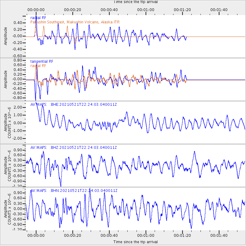
MAPS Pakushin Southeast, Makushin Volcano, Alaska - Earthquake Result Viewer
*The percent match for this event was below the threshold and hence no stack was calculated.
| Earthquake location: |
Fiji Islands Region |
| Earthquake latitude/longitude: |
-16.6/-177.4 |
| Earthquake time(UTC): |
2021/05/21 (141) 22:13:18 GMT |
| Earthquake Depth: |
10 km |
| Earthquake Magnitude: |
6.5 mww |
| Earthquake Catalog/Contributor: |
NEIC PDE/us |
|
| Network: |
AV Alaska Volcano Observatory |
| Station: |
MAPS Pakushin Southeast, Makushin Volcano, Alaska |
| Lat/Lon: |
53.81 N/166.94 W |
| Elevation: |
333 m |
|
| Distance: |
70.7 deg |
| Az: |
6.534 deg |
| Baz: |
190.6 deg |
| Ray Param: |
$rayparam |
*The percent match for this event was below the threshold and hence was not used in the summary stack. |
|
| Radial Match: |
63.149677 % |
| Radial Bump: |
400 |
| Transverse Match: |
63.37921 % |
| Transverse Bump: |
332 |
| SOD ConfigId: |
25028951 |
| Insert Time: |
2021-06-04 22:18:17.013 +0000 |
| GWidth: |
2.5 |
| Max Bumps: |
400 |
| Tol: |
0.001 |
|
Signal To Noise
| Channel | StoN | STA | LTA |
| AV:MAPS: :BHZ:20210521T22:24:03.040011Z | 1.1908375 | 4.477744E-7 | 3.7601637E-7 |
| AV:MAPS: :BHN:20210521T22:24:03.040011Z | 1.0790635 | 3.838412E-7 | 3.55717E-7 |
| AV:MAPS: :BHE:20210521T22:24:03.040011Z | 0.88839096 | 7.441636E-7 | 8.3765326E-7 |
| Arrivals |
| Ps | |
| PpPs | |
| PsPs/PpSs | |


