You are here: Home > Network List > G - GEOSCOPE Stations List
> Station INU Inuyama, Japan > Earthquake Result Viewer
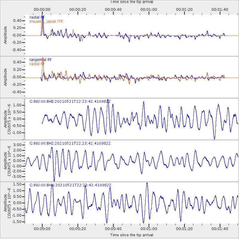
INU Inuyama, Japan - Earthquake Result Viewer
*The percent match for this event was below the threshold and hence no stack was calculated.
| Earthquake location: |
Fiji Islands Region |
| Earthquake latitude/longitude: |
-16.6/-177.4 |
| Earthquake time(UTC): |
2021/05/21 (141) 22:13:18 GMT |
| Earthquake Depth: |
10 km |
| Earthquake Magnitude: |
6.5 mww |
| Earthquake Catalog/Contributor: |
NEIC PDE/us |
|
| Network: |
G GEOSCOPE |
| Station: |
INU Inuyama, Japan |
| Lat/Lon: |
35.35 N/137.03 E |
| Elevation: |
132 m |
|
| Distance: |
67.4 deg |
| Az: |
320.744 deg |
| Baz: |
132.079 deg |
| Ray Param: |
$rayparam |
*The percent match for this event was below the threshold and hence was not used in the summary stack. |
|
| Radial Match: |
77.84332 % |
| Radial Bump: |
316 |
| Transverse Match: |
69.40471 % |
| Transverse Bump: |
400 |
| SOD ConfigId: |
25028951 |
| Insert Time: |
2021-06-04 22:23:52.907 +0000 |
| GWidth: |
2.5 |
| Max Bumps: |
400 |
| Tol: |
0.001 |
|
Signal To Noise
| Channel | StoN | STA | LTA |
| G:INU:00:BHZ:20210521T22:23:42.410982Z | 2.0041404 | 1.0821009E-6 | 5.3993267E-7 |
| G:INU:00:BHN:20210521T22:23:42.410982Z | 1.0540237 | 6.483591E-7 | 6.151276E-7 |
| G:INU:00:BHE:20210521T22:23:42.410982Z | 1.9196928 | 6.1055755E-7 | 3.1804962E-7 |
| Arrivals |
| Ps | |
| PpPs | |
| PsPs/PpSs | |


