You are here: Home > Network List > II - Global Seismograph Network (GSN - IRIS/IDA) Stations List
> Station PFO Pinon Flat, California, USA > Earthquake Result Viewer
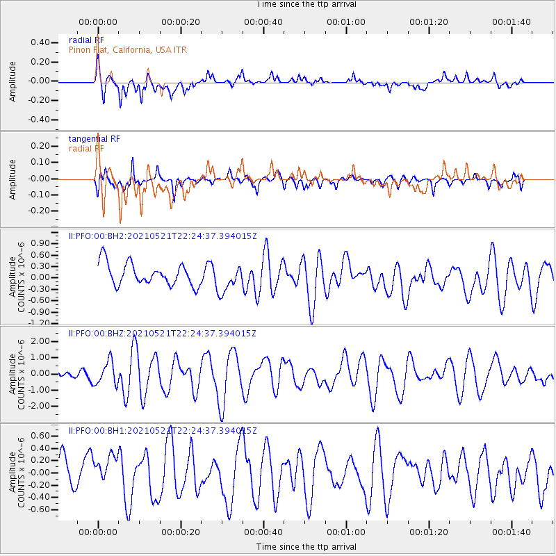
PFO Pinon Flat, California, USA - Earthquake Result Viewer
*The percent match for this event was below the threshold and hence no stack was calculated.
| Earthquake location: |
Fiji Islands Region |
| Earthquake latitude/longitude: |
-16.6/-177.4 |
| Earthquake time(UTC): |
2021/05/21 (141) 22:13:18 GMT |
| Earthquake Depth: |
10 km |
| Earthquake Magnitude: |
6.5 mww |
| Earthquake Catalog/Contributor: |
NEIC PDE/us |
|
| Network: |
II Global Seismograph Network (GSN - IRIS/IDA) |
| Station: |
PFO Pinon Flat, California, USA |
| Lat/Lon: |
33.61 N/116.46 W |
| Elevation: |
1280 m |
|
| Distance: |
76.6 deg |
| Az: |
48.578 deg |
| Baz: |
239.492 deg |
| Ray Param: |
$rayparam |
*The percent match for this event was below the threshold and hence was not used in the summary stack. |
|
| Radial Match: |
70.33419 % |
| Radial Bump: |
400 |
| Transverse Match: |
65.320114 % |
| Transverse Bump: |
400 |
| SOD ConfigId: |
25028951 |
| Insert Time: |
2021-06-04 22:24:55.262 +0000 |
| GWidth: |
2.5 |
| Max Bumps: |
400 |
| Tol: |
0.001 |
|
Signal To Noise
| Channel | StoN | STA | LTA |
| II:PFO:00:BHZ:20210521T22:24:37.394015Z | 2.7674086 | 7.263748E-7 | 2.6247474E-7 |
| II:PFO:00:BH1:20210521T22:24:37.394015Z | 1.3101542 | 3.1412006E-7 | 2.397581E-7 |
| II:PFO:00:BH2:20210521T22:24:37.394015Z | 1.2594583 | 3.6426349E-7 | 2.8922236E-7 |
| Arrivals |
| Ps | |
| PpPs | |
| PsPs/PpSs | |


