You are here: Home > Network List > IU - Global Seismograph Network (GSN - IRIS/USGS) Stations List
> Station RSSD Black Hills, South Dakota, USA > Earthquake Result Viewer
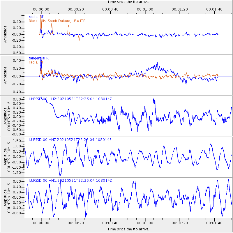
RSSD Black Hills, South Dakota, USA - Earthquake Result Viewer
*The percent match for this event was below the threshold and hence no stack was calculated.
| Earthquake location: |
Near Coast Of Nicaragua |
| Earthquake latitude/longitude: |
12.5/-87.7 |
| Earthquake time(UTC): |
2021/05/21 (141) 22:19:51 GMT |
| Earthquake Depth: |
56 km |
| Earthquake Magnitude: |
5.5 Mwr |
| Earthquake Catalog/Contributor: |
NEIC PDE/us |
|
| Network: |
IU Global Seismograph Network (GSN - IRIS/USGS) |
| Station: |
RSSD Black Hills, South Dakota, USA |
| Lat/Lon: |
44.12 N/104.04 W |
| Elevation: |
2090 m |
|
| Distance: |
34.5 deg |
| Az: |
339.043 deg |
| Baz: |
150.983 deg |
| Ray Param: |
$rayparam |
*The percent match for this event was below the threshold and hence was not used in the summary stack. |
|
| Radial Match: |
64.59811 % |
| Radial Bump: |
400 |
| Transverse Match: |
72.63416 % |
| Transverse Bump: |
400 |
| SOD ConfigId: |
25028951 |
| Insert Time: |
2021-06-04 22:44:39.013 +0000 |
| GWidth: |
2.5 |
| Max Bumps: |
400 |
| Tol: |
0.001 |
|
Signal To Noise
| Channel | StoN | STA | LTA |
| IU:RSSD:00:HHZ:20210521T22:26:04.108014Z | 1.1279655 | 4.9335296E-7 | 4.3738305E-7 |
| IU:RSSD:00:HH1:20210521T22:26:04.108014Z | 1.0789686 | 4.3085458E-7 | 3.9932078E-7 |
| IU:RSSD:00:HH2:20210521T22:26:04.108014Z | 0.9954896 | 3.4086295E-7 | 3.4240736E-7 |
| Arrivals |
| Ps | |
| PpPs | |
| PsPs/PpSs | |


