KSA XW.KSA - Earthquake Result Viewer
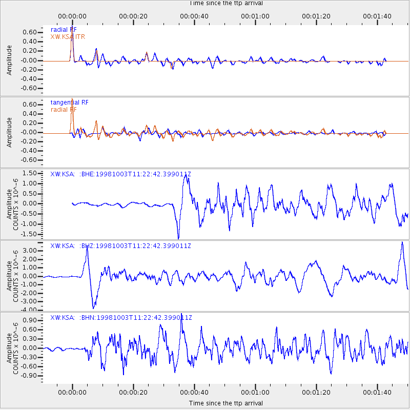
Earthquake location: Northwest Of Ryukyu Islands
Earthquake latitude/longitude: 28.5/127.6
Earthquake time(UTC): 1998/10/03 (276) 11:15:42 GMT
Earthquake Depth: 227 km
Earthquake Magnitude: 5.6 MB, 6.1 UNKNOWN, 6.1 MW
Earthquake Catalog/Contributor: WHDF/NEIC
Network: XW Tien Shan Continental Dynamics
Station: KSA XW.KSA
Lat/Lon: 41.54 N/77.93 E
Elevation: 3398 m
Distance: 42.2 deg
Az: 301.51 deg
Baz: 91.688 deg
Ray Param: 0.07243481
Estimated Moho Depth: 26.5 km
Estimated Crust Vp/Vs: 1.64
Assumed Crust Vp: 6.491 km/s
Estimated Crust Vs: 3.964 km/s
Estimated Crust Poisson's Ratio: 0.20
Radial Match: 88.16992 %
Radial Bump: 400
Transverse Match: 66.47885 %
Transverse Bump: 400
SOD ConfigId: 4480
Insert Time: 2010-02-26 15:37:24.506 +0000
GWidth: 2.5
Max Bumps: 400
Tol: 0.001

Signal To Noise

ChannelStoNSTALTA
XW:KSA: :BHZ:19981003T11:22:42.399011Z21.4517421.1150214E-65.197813E-8
XW:KSA: :BHN:19981003T11:22:42.399011Z0.454189482.1185302E-84.6644196E-8
XW:KSA: :BHE:19981003T11:22:42.399011Z8.1685355.1296337E-76.2797476E-8
Arrivals
Ps2.8 SECOND
PpPs10 SECOND
PsPs/PpSs13 SECOND