You are here: Home > Network List > GS - US Geological Survey Networks Stations List
> Station KAN13 Rinehart Farm > Earthquake Result Viewer
KAN13 Rinehart Farm - Earthquake Result Viewer
*The percent match for this event was below the threshold and hence no stack was calculated.
| Earthquake location: |
Northern Chile |
| Earthquake latitude/longitude: |
-19.8/-69.2 |
| Earthquake time(UTC): |
2017/11/17 (321) 16:45:46 GMT |
| Earthquake Depth: |
97 km |
| Earthquake Magnitude: |
5.0 Mww |
| Earthquake Catalog/Contributor: |
NEIC PDE/us |
|
| Network: |
GS US Geological Survey Networks |
| Station: |
KAN13 Rinehart Farm |
| Lat/Lon: |
37.01 N/97.48 W |
| Elevation: |
340 m |
|
| Distance: |
62.5 deg |
| Az: |
334.656 deg |
| Baz: |
149.769 deg |
| Ray Param: |
$rayparam |
*The percent match for this event was below the threshold and hence was not used in the summary stack. |
|
| Radial Match: |
46.85573 % |
| Radial Bump: |
400 |
| Transverse Match: |
51.618507 % |
| Transverse Bump: |
400 |
| SOD ConfigId: |
2429771 |
| Insert Time: |
2017-12-17 16:53:10.934 +0000 |
| GWidth: |
2.5 |
| Max Bumps: |
400 |
| Tol: |
0.001 |
|
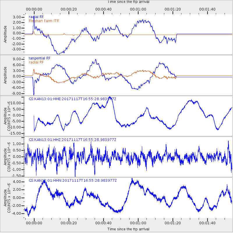
Signal To Noise
| Channel | StoN | STA | LTA |
| GS:KAN13:01:HHZ:20171117T16:55:28.983977Z | 0.6907386 | 3.573596E-7 | 5.173586E-7 |
| GS:KAN13:01:HHN:20171117T16:55:28.983977Z | 0.96040785 | 2.3530615E-6 | 2.4500648E-6 |
| GS:KAN13:01:HHE:20171117T16:55:28.983977Z | 2.5308495 | 1.0201084E-5 | 4.030696E-6 |
| Arrivals |
| Ps | |
| PpPs | |
| PsPs/PpSs | |


