You are here: Home > Network List > IW - Intermountain West Stations List
> Station MOOW Moose Ponds, Wyoming, USA > Earthquake Result Viewer
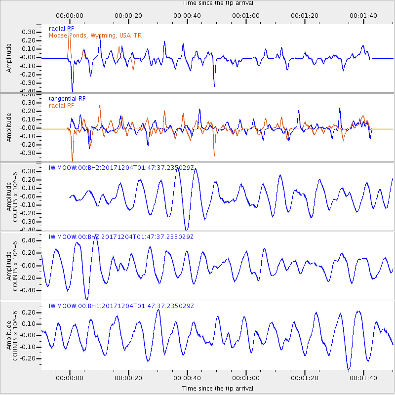
MOOW Moose Ponds, Wyoming, USA - Earthquake Result Viewer
*The percent match for this event was below the threshold and hence no stack was calculated.
| Earthquake location: |
Vanuatu Islands Region |
| Earthquake latitude/longitude: |
-13.9/170.4 |
| Earthquake time(UTC): |
2017/12/04 (338) 01:35:01 GMT |
| Earthquake Depth: |
10 km |
| Earthquake Magnitude: |
5.5 Mww |
| Earthquake Catalog/Contributor: |
NEIC PDE/us |
|
| Network: |
IW Intermountain West |
| Station: |
MOOW Moose Ponds, Wyoming, USA |
| Lat/Lon: |
43.75 N/110.74 W |
| Elevation: |
2128 m |
|
| Distance: |
91.7 deg |
| Az: |
45.343 deg |
| Baz: |
252.376 deg |
| Ray Param: |
$rayparam |
*The percent match for this event was below the threshold and hence was not used in the summary stack. |
|
| Radial Match: |
68.23481 % |
| Radial Bump: |
349 |
| Transverse Match: |
60.80919 % |
| Transverse Bump: |
364 |
| SOD ConfigId: |
2429771 |
| Insert Time: |
2017-12-18 01:36:31.743 +0000 |
| GWidth: |
2.5 |
| Max Bumps: |
400 |
| Tol: |
0.001 |
|
Signal To Noise
| Channel | StoN | STA | LTA |
| IW:MOOW:00:BHZ:20171204T01:47:37.235029Z | 1.8640487 | 2.9237157E-7 | 1.568476E-7 |
| IW:MOOW:00:BH1:20171204T01:47:37.235029Z | 1.0329565 | 7.22919E-8 | 6.9985425E-8 |
| IW:MOOW:00:BH2:20171204T01:47:37.235029Z | 1.8229667 | 1.572353E-7 | 8.6252435E-8 |
| Arrivals |
| Ps | |
| PpPs | |
| PsPs/PpSs | |


