You are here: Home > Network List > UW - Pacific Northwest Regional Seismic Network Stations List
> Station UMAT Pilot Rock, OR, USA > Earthquake Result Viewer
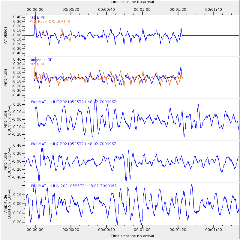
UMAT Pilot Rock, OR, USA - Earthquake Result Viewer
*The percent match for this event was below the threshold and hence no stack was calculated.
| Earthquake location: |
Tonga Islands |
| Earthquake latitude/longitude: |
-17.6/-174.8 |
| Earthquake time(UTC): |
2021/05/25 (145) 21:36:44 GMT |
| Earthquake Depth: |
200 km |
| Earthquake Magnitude: |
5.7 mww |
| Earthquake Catalog/Contributor: |
NEIC PDE/us |
|
| Network: |
UW Pacific Northwest Regional Seismic Network |
| Station: |
UMAT Pilot Rock, OR, USA |
| Lat/Lon: |
45.29 N/118.96 W |
| Elevation: |
1318 m |
|
| Distance: |
80.5 deg |
| Az: |
36.325 deg |
| Baz: |
233.176 deg |
| Ray Param: |
$rayparam |
*The percent match for this event was below the threshold and hence was not used in the summary stack. |
|
| Radial Match: |
52.87411 % |
| Radial Bump: |
269 |
| Transverse Match: |
55.321896 % |
| Transverse Bump: |
332 |
| SOD ConfigId: |
25028951 |
| Insert Time: |
2021-06-08 21:57:17.559 +0000 |
| GWidth: |
2.5 |
| Max Bumps: |
400 |
| Tol: |
0.001 |
|
Signal To Noise
| Channel | StoN | STA | LTA |
| UW:UMAT: :HHZ:20210525T21:48:02.709996Z | 3.39053 | 2.4111858E-7 | 7.11153E-8 |
| UW:UMAT: :HHN:20210525T21:48:02.709996Z | 1.8764518 | 1.1654691E-7 | 6.211026E-8 |
| UW:UMAT: :HHE:20210525T21:48:02.709996Z | 1.7795725 | 1.5654507E-7 | 8.79678E-8 |
| Arrivals |
| Ps | |
| PpPs | |
| PsPs/PpSs | |


