You are here: Home > Network List > PF - Volcanologic Network of Piton de Fournaise-OVPF Stations List
> Station GPN Grandes Pentes Nord > Earthquake Result Viewer
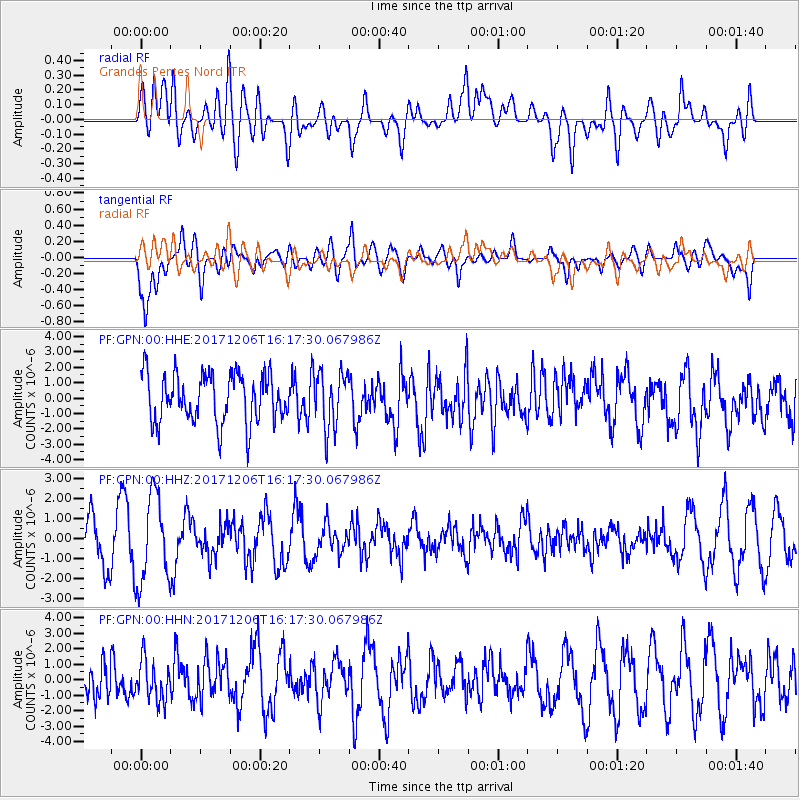
GPN Grandes Pentes Nord - Earthquake Result Viewer
*The percent match for this event was below the threshold and hence no stack was calculated.
| Earthquake location: |
Minahassa Peninsula, Sulawesi |
| Earthquake latitude/longitude: |
-0.6/123.7 |
| Earthquake time(UTC): |
2017/12/06 (340) 16:06:55 GMT |
| Earthquake Depth: |
18 km |
| Earthquake Magnitude: |
5.6 mb |
| Earthquake Catalog/Contributor: |
NEIC PDE/us |
|
| Network: |
PF Volcanologic Network of Piton de Fournaise-OVPF |
| Station: |
GPN Grandes Pentes Nord |
| Lat/Lon: |
21.24 S/55.75 E |
| Elevation: |
1413 m |
|
| Distance: |
69.2 deg |
| Az: |
247.594 deg |
| Baz: |
82.288 deg |
| Ray Param: |
$rayparam |
*The percent match for this event was below the threshold and hence was not used in the summary stack. |
|
| Radial Match: |
44.614628 % |
| Radial Bump: |
400 |
| Transverse Match: |
57.618027 % |
| Transverse Bump: |
400 |
| SOD ConfigId: |
2429771 |
| Insert Time: |
2017-12-20 16:08:33.854 +0000 |
| GWidth: |
2.5 |
| Max Bumps: |
400 |
| Tol: |
0.001 |
|
Signal To Noise
| Channel | StoN | STA | LTA |
| PF:GPN:00:HHZ:20171206T16:17:30.067986Z | 2.6684816 | 2.1606907E-6 | 8.0970784E-7 |
| PF:GPN:00:HHN:20171206T16:17:30.067986Z | 1.0166956 | 1.3251888E-6 | 1.3034273E-6 |
| PF:GPN:00:HHE:20171206T16:17:30.067986Z | 1.169414 | 1.8337508E-6 | 1.5680936E-6 |
| Arrivals |
| Ps | |
| PpPs | |
| PsPs/PpSs | |


