You are here: Home > Network List > UU - University of Utah Regional Network Stations List
> Station FORU South Mineral Mountains, UT, USA > Earthquake Result Viewer
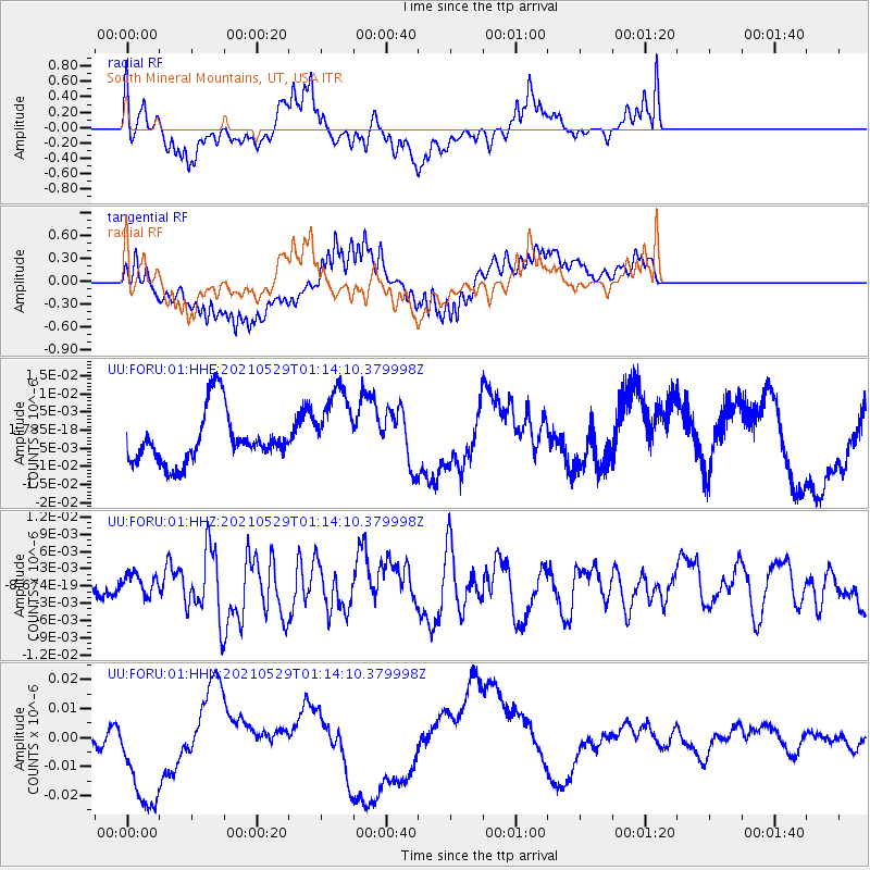
FORU South Mineral Mountains, UT, USA - Earthquake Result Viewer
*The percent match for this event was below the threshold and hence no stack was calculated.
| Earthquake location: |
Off East Coast Of Honshu, Japan |
| Earthquake latitude/longitude: |
36.3/142.0 |
| Earthquake time(UTC): |
2021/05/29 (149) 01:02:40 GMT |
| Earthquake Depth: |
7.5 km |
| Earthquake Magnitude: |
5.5 mww |
| Earthquake Catalog/Contributor: |
NEIC PDE/us |
|
| Network: |
UU University of Utah Regional Network |
| Station: |
FORU South Mineral Mountains, UT, USA |
| Lat/Lon: |
38.46 N/112.86 W |
| Elevation: |
1840 m |
|
| Distance: |
78.5 deg |
| Az: |
50.675 deg |
| Baz: |
307.274 deg |
| Ray Param: |
$rayparam |
*The percent match for this event was below the threshold and hence was not used in the summary stack. |
|
| Radial Match: |
40.540203 % |
| Radial Bump: |
400 |
| Transverse Match: |
64.95895 % |
| Transverse Bump: |
400 |
| SOD ConfigId: |
25028951 |
| Insert Time: |
2021-06-12 01:20:47.512 +0000 |
| GWidth: |
2.5 |
| Max Bumps: |
400 |
| Tol: |
0.001 |
|
Signal To Noise
| Channel | StoN | STA | LTA |
| UU:FORU:01:HHZ:20210529T01:14:10.379998Z | 0.706897 | 1.8576226E-9 | 2.6278546E-9 |
| UU:FORU:01:HHN:20210529T01:14:10.379998Z | 7.2234464 | 2.1703666E-8 | 3.0046137E-9 |
| UU:FORU:01:HHE:20210529T01:14:10.379998Z | 1.5607688 | 1.1000138E-8 | 7.0478974E-9 |
| Arrivals |
| Ps | |
| PpPs | |
| PsPs/PpSs | |


