KSA XW.KSA - Earthquake Result Viewer
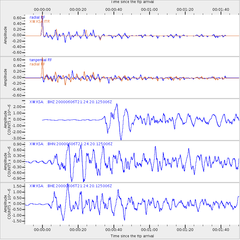
Earthquake location: Sea Of Japan
Earthquake latitude/longitude: 36.8/135.5
Earthquake time(UTC): 2000/06/06 (158) 21:16:42 GMT
Earthquake Depth: 10 km
Earthquake Magnitude: 5.7 MB, 5.3 MS, 5.9 MW, 5.8 MW
Earthquake Catalog/Contributor: WHDF/NEIC
Network: XW Tien Shan Continental Dynamics
Station: KSA XW.KSA
Lat/Lon: 41.54 N/77.93 E
Elevation: 3398 m
Distance: 44.1 deg
Az: 294.573 deg
Baz: 76.421 deg
Ray Param: 0.072098024
Estimated Moho Depth: 59.25 km
Estimated Crust Vp/Vs: 1.74
Assumed Crust Vp: 6.491 km/s
Estimated Crust Vs: 3.73 km/s
Estimated Crust Poisson's Ratio: 0.25
Radial Match: 89.44451 %
Radial Bump: 343
Transverse Match: 76.050804 %
Transverse Bump: 400
SOD ConfigId: 20082
Insert Time: 2010-02-26 15:37:57.827 +0000
GWidth: 2.5
Max Bumps: 400
Tol: 0.001

Signal To Noise

ChannelStoNSTALTA
XW:KSA: :BHN:20000606T21:24:20.125006Z1.97082355.573914E-82.8282157E-8
XW:KSA: :BHE:20000606T21:24:20.125006Z2.00025499.053006E-84.5259263E-8
XW:KSA: :BHZ:20000606T21:24:20.125006Z4.9877291.8889038E-73.787102E-8
Arrivals
Ps7.2 SECOND
PpPs23 SECOND
PsPs/PpSs31 SECOND