KSA XW.KSA - Earthquake Result Viewer
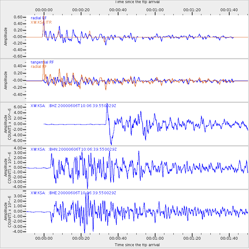
Earthquake location: Southern Sumatra, Indonesia
Earthquake latitude/longitude: -5.1/102.7
Earthquake time(UTC): 2000/06/06 (158) 09:58:06 GMT
Earthquake Depth: 33 km
Earthquake Magnitude: 5.8 MB, 6.1 MS, 6.2 MW, 6.1 MW
Earthquake Catalog/Contributor: WHDF/NEIC
Network: XW Tien Shan Continental Dynamics
Station: KSA XW.KSA
Lat/Lon: 41.54 N/77.93 E
Elevation: 3398 m
Distance: 51.6 deg
Az: 336.348 deg
Baz: 147.836 deg
Ray Param: 0.0672222
Estimated Moho Depth: 18.5 km
Estimated Crust Vp/Vs: 2.09
Assumed Crust Vp: 6.491 km/s
Estimated Crust Vs: 3.113 km/s
Estimated Crust Poisson's Ratio: 0.35
Radial Match: 86.26461 %
Radial Bump: 400
Transverse Match: 74.42185 %
Transverse Bump: 400
SOD ConfigId: 20082
Insert Time: 2010-02-26 15:37:59.497 +0000
GWidth: 2.5
Max Bumps: 400
Tol: 0.001

Signal To Noise

ChannelStoNSTALTA
XW:KSA: :BHN:20000606T10:06:39.550029Z23.811748.459934E-73.5528416E-8
XW:KSA: :BHE:20000606T10:06:39.550029Z14.4355645.678758E-73.9338666E-8
XW:KSA: :BHZ:20000606T10:06:39.550029Z38.7881052.3041105E-65.9402502E-8
Arrivals
Ps3.2 SECOND
PpPs8.4 SECOND
PsPs/PpSs12 SECOND