KSA XW.KSA - Earthquake Result Viewer
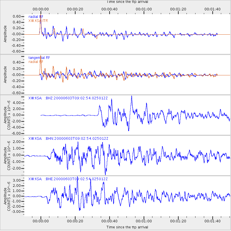
Earthquake location: Near East Coast Of Honshu, Japan
Earthquake latitude/longitude: 35.6/140.5
Earthquake time(UTC): 2000/06/03 (155) 08:54:49 GMT
Earthquake Depth: 62 km
Earthquake Magnitude: 5.6 MB, 5.6 MS, 6.1 MW, 6.1 MW
Earthquake Catalog/Contributor: WHDF/NEIC
Network: XW Tien Shan Continental Dynamics
Station: KSA XW.KSA
Lat/Lon: 41.54 N/77.93 E
Elevation: 3398 m
Distance: 48.3 deg
Az: 296.929 deg
Baz: 75.577 deg
Ray Param: 0.06924375
Estimated Moho Depth: 59.25 km
Estimated Crust Vp/Vs: 1.74
Assumed Crust Vp: 6.491 km/s
Estimated Crust Vs: 3.73 km/s
Estimated Crust Poisson's Ratio: 0.25
Radial Match: 90.63922 %
Radial Bump: 400
Transverse Match: 83.316536 %
Transverse Bump: 400
SOD ConfigId: 20082
Insert Time: 2010-02-26 15:38:07.093 +0000
GWidth: 2.5
Max Bumps: 400
Tol: 0.001

Signal To Noise

ChannelStoNSTALTA
XW:KSA: :BHN:20000603T09:02:54.025012Z2.44517851.3180853E-75.3905485E-8
XW:KSA: :BHE:20000603T09:02:54.025012Z9.3277744.6862098E-75.0239315E-8
XW:KSA: :BHZ:20000603T09:02:54.025012Z16.3838331.1254358E-66.8691854E-8
Arrivals
Ps7.2 SECOND
PpPs23 SECOND
PsPs/PpSs31 SECOND