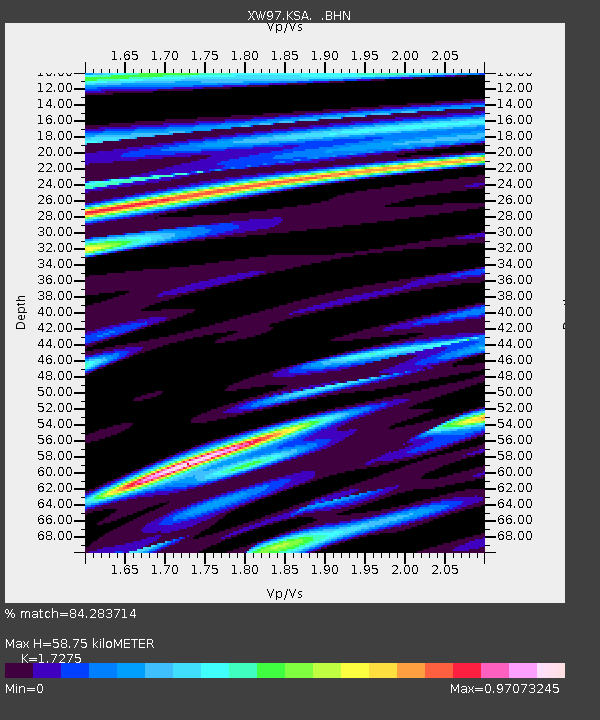
KSA XW.KSA - Earthquake Result Viewer

Earthquake location: Mariana Islands
Earthquake latitude/longitude: 13.8/144.8
Earthquake time(UTC): 2000/02/26 (057) 08:11:48 GMT
Earthquake Depth: 132 km
Earthquake Magnitude: 6.0 MB, 5.4 MS, 6.2 MW, 6.2 MW
Earthquake Catalog/Contributor: WHDF/NEIC
Network: XW Tien Shan Continental Dynamics
Station: KSA XW.KSA
Lat/Lon: 41.54 N/77.93 E
Elevation: 3398 m
Distance: 63.7 deg
Az: 309.646 deg
Baz: 94.762 deg
Ray Param: 0.059030175
Estimated Moho Depth: 58.75 km
Estimated Crust Vp/Vs: 1.73
Assumed Crust Vp: 6.491 km/s
Estimated Crust Vs: 3.757 km/s
Estimated Crust Poisson's Ratio: 0.25
Radial Match: 84.283714 %
Radial Bump: 400
Transverse Match: 79.113754 %
Transverse Bump: 400
SOD ConfigId: 20082
Insert Time: 2010-02-26 15:38:24.753 +0000
GWidth: 2.5
Max Bumps: 400
Tol: 0.001

Signal To Noise

ChannelStoNSTALTA
XW:KSA: :BHN:20000226T08:21:35.025022Z1.30869737.7798205E-85.9447057E-8
XW:KSA: :BHE:20000226T08:21:35.025022Z2.1970431.7560106E-77.9926096E-8
XW:KSA: :BHZ:20000226T08:21:35.025022Z4.1601033.8861535E-79.341484E-8
Arrivals
Ps6.9 SECOND
PpPs24 SECOND
PsPs/PpSs30 SECOND