You are here: Home > Network List > AV - Alaska Volcano Observatory Stations List
> Station MAPS Pakushin Southeast, Makushin Volcano, Alaska > Earthquake Result Viewer
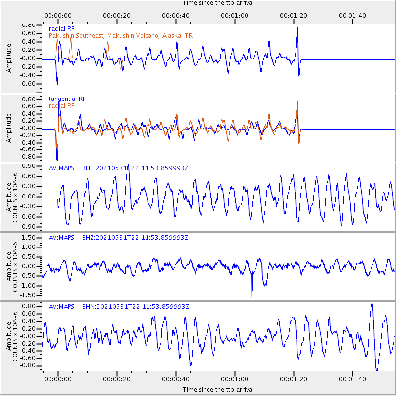
MAPS Pakushin Southeast, Makushin Volcano, Alaska - Earthquake Result Viewer
*The percent match for this event was below the threshold and hence no stack was calculated.
| Earthquake location: |
Off East Coast Of Honshu, Japan |
| Earthquake latitude/longitude: |
33.2/142.7 |
| Earthquake time(UTC): |
2021/05/31 (151) 22:04:42 GMT |
| Earthquake Depth: |
10 km |
| Earthquake Magnitude: |
5.2 Mww |
| Earthquake Catalog/Contributor: |
NEIC PDE/us |
|
| Network: |
AV Alaska Volcano Observatory |
| Station: |
MAPS Pakushin Southeast, Makushin Volcano, Alaska |
| Lat/Lon: |
53.81 N/166.94 W |
| Elevation: |
333 m |
|
| Distance: |
40.9 deg |
| Az: |
44.228 deg |
| Baz: |
260.545 deg |
| Ray Param: |
$rayparam |
*The percent match for this event was below the threshold and hence was not used in the summary stack. |
|
| Radial Match: |
50.62268 % |
| Radial Bump: |
400 |
| Transverse Match: |
65.54811 % |
| Transverse Bump: |
400 |
| SOD ConfigId: |
25028951 |
| Insert Time: |
2021-06-14 22:08:54.170 +0000 |
| GWidth: |
2.5 |
| Max Bumps: |
400 |
| Tol: |
0.001 |
|
Signal To Noise
| Channel | StoN | STA | LTA |
| AV:MAPS: :BHZ:20210531T22:11:53.859993Z | 1.9723192 | 3.8128942E-7 | 1.9332035E-7 |
| AV:MAPS: :BHN:20210531T22:11:53.859993Z | 0.80520475 | 1.9877629E-7 | 2.468643E-7 |
| AV:MAPS: :BHE:20210531T22:11:53.859993Z | 0.8109181 | 3.1823416E-7 | 3.9243687E-7 |
| Arrivals |
| Ps | |
| PpPs | |
| PsPs/PpSs | |


