You are here: Home > Network List > PF - Volcanologic Network of Piton de Fournaise-OVPF Stations List
> Station HIM cratere Himiltrude > Earthquake Result Viewer
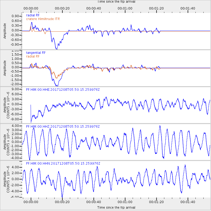
HIM cratere Himiltrude - Earthquake Result Viewer
*The percent match for this event was below the threshold and hence no stack was calculated.
| Earthquake location: |
W. Caroline Islands, Micronesia |
| Earthquake latitude/longitude: |
10.0/140.1 |
| Earthquake time(UTC): |
2017/12/08 (342) 05:37:54 GMT |
| Earthquake Depth: |
10 km |
| Earthquake Magnitude: |
5.5 mb |
| Earthquake Catalog/Contributor: |
NEIC PDE/us |
|
| Network: |
PF Volcanologic Network of Piton de Fournaise-OVPF |
| Station: |
HIM cratere Himiltrude |
| Lat/Lon: |
21.21 S/55.72 E |
| Elevation: |
1958 m |
|
| Distance: |
88.4 deg |
| Az: |
248.276 deg |
| Baz: |
78.734 deg |
| Ray Param: |
$rayparam |
*The percent match for this event was below the threshold and hence was not used in the summary stack. |
|
| Radial Match: |
47.096233 % |
| Radial Bump: |
400 |
| Transverse Match: |
47.63922 % |
| Transverse Bump: |
400 |
| SOD ConfigId: |
2429771 |
| Insert Time: |
2017-12-22 05:40:00.799 +0000 |
| GWidth: |
2.5 |
| Max Bumps: |
400 |
| Tol: |
0.001 |
|
Signal To Noise
| Channel | StoN | STA | LTA |
| PF:HIM:00:HHZ:20171208T05:50:15.259976Z | 1.7498087 | 2.6561581E-6 | 1.5179706E-6 |
| PF:HIM:00:HHN:20171208T05:50:15.259976Z | 1.024779 | 3.783815E-6 | 3.692323E-6 |
| PF:HIM:00:HHE:20171208T05:50:15.259976Z | 0.68990856 | 2.1494338E-6 | 3.1155344E-6 |
| Arrivals |
| Ps | |
| PpPs | |
| PsPs/PpSs | |


