
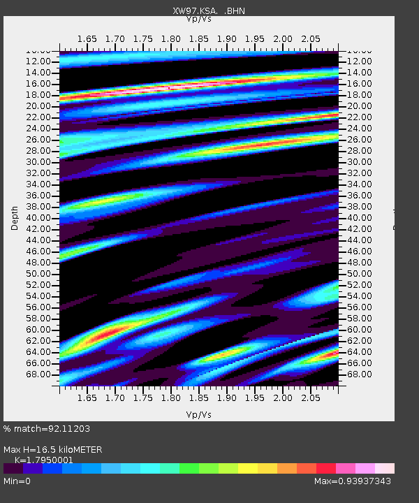
KSA XW.KSA - Earthquake Result Viewer
| ||||||||||||||||||
| ||||||||||||||||||
| ||||||||||||||||||
|
Signal To Noise
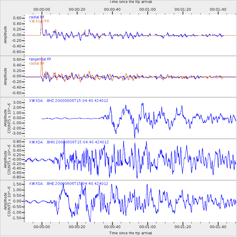
| Channel | StoN | STA | LTA |
| XW:KSA: :BHN:20000606T15:04:40.42401Z | 0.8659227 | 3.0331027E-8 | 3.5027405E-8 |
| XW:KSA: :BHE:20000606T15:04:40.42401Z | 1.3421384 | 6.1528894E-8 | 4.5843926E-8 |
| XW:KSA: :BHZ:20000606T15:04:40.42401Z | 1.5829419 | 1.06780284E-7 | 6.745686E-8 |
| Arrivals | |
| Ps | 2.2 SECOND |
| PpPs | 6.7 SECOND |
| PsPs/PpSs | 8.8 SECOND |

