KSA XW.KSA - Earthquake Result Viewer
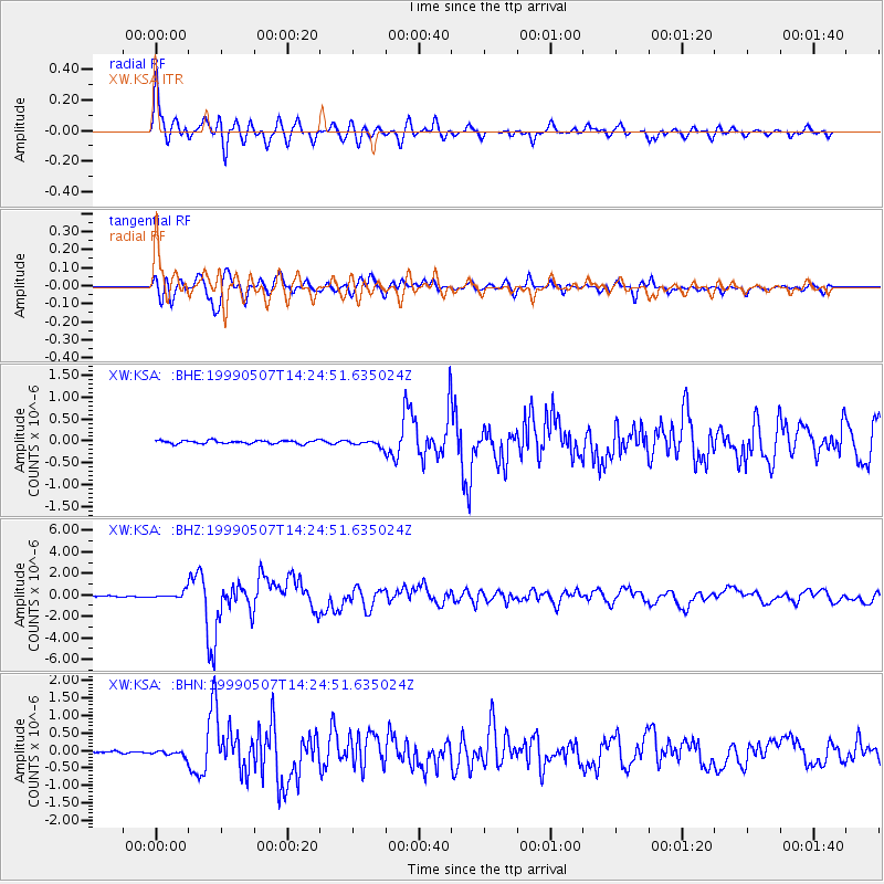
Earthquake location: Kodiak Island Region, Alaska
Earthquake latitude/longitude: 56.4/-152.9
Earthquake time(UTC): 1999/05/07 (127) 14:13:52 GMT
Earthquake Depth: 20 km
Earthquake Magnitude: 5.7 MB, 6.1 MS, 6.4 MW, 5.7 ME
Earthquake Catalog/Contributor: WHDF/NEIC
Network: XW Tien Shan Continental Dynamics
Station: KSA XW.KSA
Lat/Lon: 41.54 N/77.93 E
Elevation: 3398 m
Distance: 73.4 deg
Az: 322.581 deg
Baz: 26.734 deg
Ray Param: 0.05302052
Estimated Moho Depth: 16.75 km
Estimated Crust Vp/Vs: 2.09
Assumed Crust Vp: 6.491 km/s
Estimated Crust Vs: 3.102 km/s
Estimated Crust Poisson's Ratio: 0.35
Radial Match: 92.18248 %
Radial Bump: 400
Transverse Match: 89.04924 %
Transverse Bump: 400
SOD ConfigId: 4480
Insert Time: 2010-02-26 15:38:39.980 +0000
GWidth: 2.5
Max Bumps: 400
Tol: 0.001

Signal To Noise

ChannelStoNSTALTA
XW:KSA: :BHZ:19990507T14:24:51.635024Z4.8986383.168812E-76.468762E-8
XW:KSA: :BHN:19990507T14:24:51.635024Z2.2791698.328207E-83.6540538E-8
XW:KSA: :BHE:19990507T14:24:51.635024Z1.89342926.93858E-83.6645577E-8
Arrivals
Ps2.9 SECOND
PpPs7.7 SECOND
PsPs/PpSs11 SECOND